


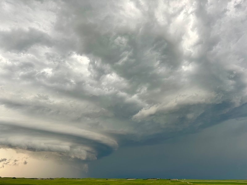
Mothership over South Dakota
It’s summertime in the Northern Hemisphere, which means thunderstorms are a regular feature in skies over the U.S. Great Plains. Amy Moberly caught this majestic supercell near Reva, South Dakota, on June 20, 2025. On that Friday afternoon, an outbreak of severe weather across the Dakotas brought strong winds, hail and tornadoes. The storms first developed in eastern Montana before producing two EF-1 and one EF-2 tornadoes in North Dakota. Other smaller and unrated tornadoes also spun up in North Dakota.
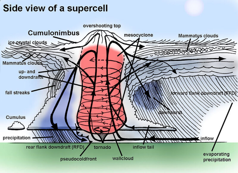
Supercells, such as the one pictured above, are thunderstorms characterized by strong updrafts and rotation. Sometimes these storms have very distinctive shapes that earn them the nickname of the mothership. These types of thunderstorms often form separately from other storms or separate off from a line of storms. And supercells are often the source of strong tornadoes. The is how the National Weather Service describes supercells:
Potentially the most dangerous of the convective storm types. Storms possessing this structure have been observed to generate the vast majority of long-lived strong and violent (F2-F5) tornadoes, as well as downburst damage and large hail.
Supercells tend to last for an hour or longer and average around 10 to 20 miles (16 to 32 km) wide. Inside supercells, you might find a radar-indicated signature for a rotating updraft known as a mesocyclone. These are usually in the rear of a supercell and often where you might find an associated tornado.
Diagram of a supercell
If you catch a great photo of a storm this summer, submit it to us!
Bottom line: Supercell thunderstorms look like giant motherships and can bring severe weather such as tornadoes and hail. See a diagram of a supercell here.
Read more: Cumulonimbus clouds bring thunderstorms: How to spot them
Like what you read?
Subscribe and receive daily news delivered to your inbox.
More from
Kelly Kizer Whitt


