


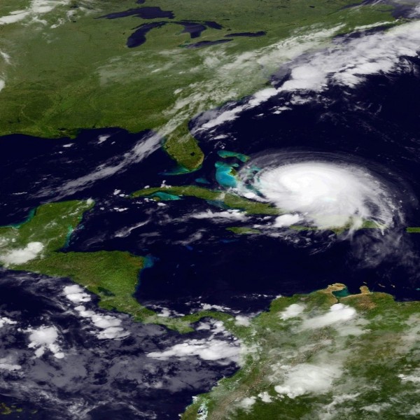
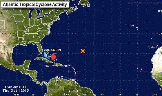
As of 5 a.m. EDT (9 UTC) today (October 1, 2015), Hurricane Joaquin is producing winds near 120 mph (195 km/h), with higher gusts. It is pushing to the west-southwest at 5-7 mph. The National Hurricane Center is forecasting Joaquin to grow into a Category 4 storm with sustained winds of 140 mph. The NHC’s latest advisory on Joaquin said:
500 AM EDT THU OCT 01 2015
…MAJOR HURRICANE JOAQUIN WILL BATTER THE CENTRAL BAHAMAS WITH HURRICANE FORCE WINDS…STORM SURGE…AND HEAVY RAIN THROUGH TONIGHT…
Read more: Joaquin likely to cause flooding along U.S. East Coast this weekend.
Like what you read?
Subscribe and receive daily news delivered to your inbox.
Thank you! Your submission has been received!
Oops! Something went wrong while submitting the form.
More from
Deborah Byrd
View All


Wildfires in Spain and France: 200,000 forced to flee
July 25, 2026
Find M4: An easy to spot globular cluster near Antares
July 22, 2026
The Day the Earth Smiled: July 19, 2013
July 19, 2026
The 1st footsteps on the moon: Celebrate with Moon Day
July 19, 2026


