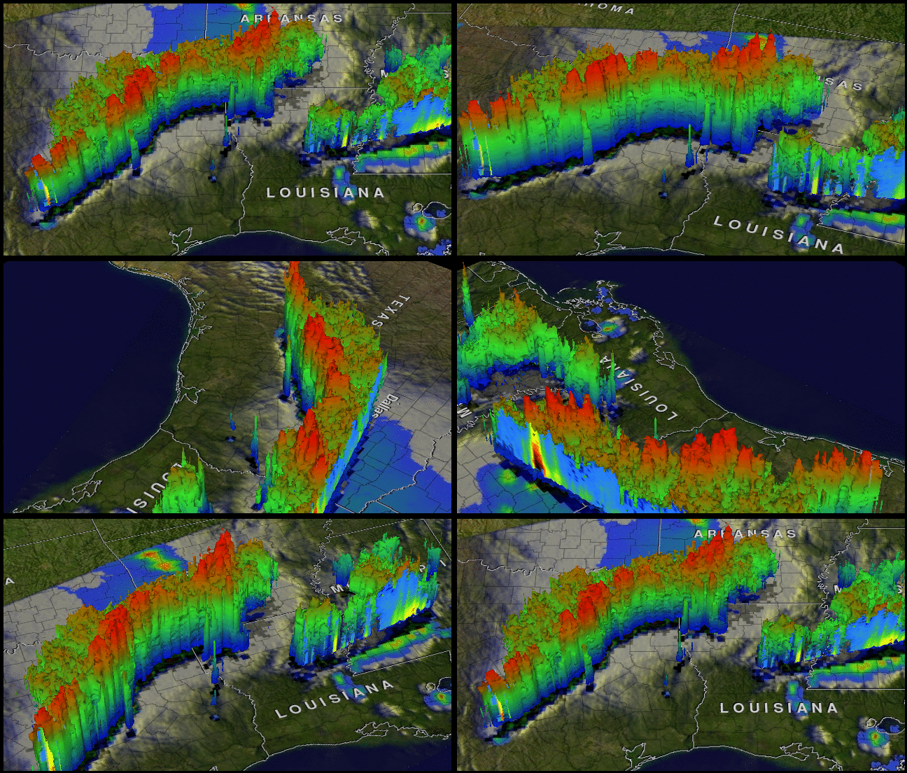
This animation of the fierce thunderstorms that blasted Texas on April 3, 2012 were created from NASA satellite data.

Recap and videos of the April 3, 2012 tornadoes in Texas
NASA’s Tropical Rainfall Measuring Mission (TRMM) satellite provides a look at thunderstorms in three dimensions and shows scientists the heights of the thunderclouds and the rainfall rates coming from them, both of which indicate severity.
The TRMM satellite passed above northeastern Texas on April 3, 2012 and gathered rainfall and cloud height data from a line of thunderstorms moving through the area. The powerful thunderstorms that created severe weather were more than 8 miles high.
NOAA’s National Weather Service Storm Prediction Center received 18 reports of tornadoes occurring on April 3 over northeastern Texas. Some of these very destructive storms dropped softball sized hail as they passed to the south of the Dallas/Fort Worth area.
More Views from space:
View from space: 2012 snow cover compared to 2011 snow cover
View from space: Video of Comet Lovejoy
View from space: Layers of atmosphere on the horizon
View from space: Crepuscular rays
View from space: US Midwest at night with aurora borealis
Bottom line: NASA’s Tropical Rainfall Measuring Mission (TRMM) satellite data provided an animated picture of the fierce thunderstorms that blasted Texas on April 3, 2012.


