


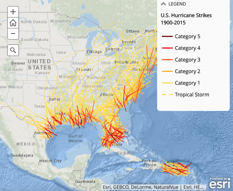
Map showing hurricane tracks that reached the U.S. East Coast, Florida, Gulf Coast, and Puerto Rico area from 1900 to 2015. You can zoom in on this map, see other parts of the world, and find more interactive maps and information here.
Like what you read?
Subscribe and receive daily news delivered to your inbox.
Thank you! Your submission has been received!
Oops! Something went wrong while submitting the form.
More from
Eleanor Imster
View All


Copernicus’ revolution and Galileo’s vision, in pictures
February 19, 2025
1st photo of Earth from space, 78 years ago
October 24, 2024
Comets and asteroids: What’s the difference?
January 31, 2023
Sputnik launched 65 years ago
October 4, 2022


