


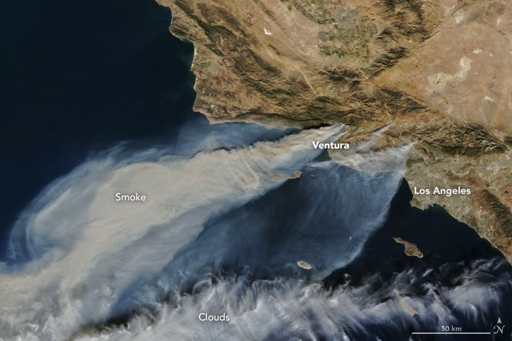
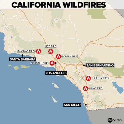
California is undergoing its worst wildfire season on record, and the smoke and flames can be seen from space. NASA Earth Observatory posted the natural-color image above last week (December 7, 2017) of thick smoke streaming from several fires in southern California. The largest of the blazes has been the fast-moving Thomas fire in Ventura County, California. By December 9, this fire had charred more than 132,000 acres (53,000 hectares or 206 square miles), according to Inciweb. Smaller smoke plumes from the Creek and Rye fires are also visible in the image above. See more space or aerial images of California’s fires from NASA Earth Observatory here and here.
Why is southern California burning in December? A climate scientist’s answer
ESA’s Copernicus satellite has been peering down on the California fires, too. Click here for interactive images from ESA.
Bottom line: A compilation of images from space, a map, and links to more stories about California’s wildfires, December 2017.
Like what you read?
Subscribe and receive daily news delivered to your inbox.
More from
Deborah Byrd


