


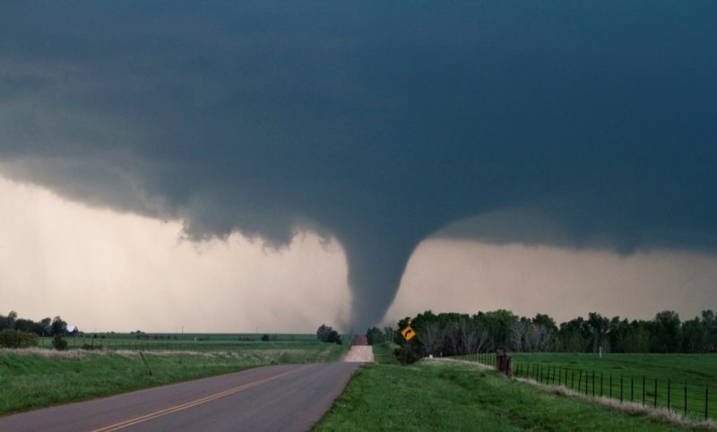
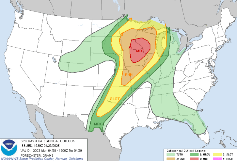
Forecasters predict a significant outbreak of severe weather – including the threat of large hail, damaging wind gusts and strong-to-intense tornadoes – in the upper U.S. Midwest on Monday, April 28. The U.S. Storm Prediction Center outlines this area in a Moderate Risk (Level 4 out of 5) for severe weather. This is the first time since April of 2011 that this region has been outlined in a moderate risk so far in advance (it was initially outlined in the Day 3 Outlook, typically issued two days in advance of a severe weather forecast). It includes cities such as Minneapolis and Saint Paul, Minnesota, La Crosse, Wisconsin and Des Moines, Iowa.
A Moderate Risk typically means long-lived and intense severe storms are forecast to be widespread.
Monday forecast: What to expect
A strong cold front associated with a strengthening low pressure will move across the upper Midwest through the day Monday. The Monday forecast shows the day as warm and muggy with some sunshine. The sunshine paired with the warm temperatures will energize the atmosphere, creating an environment that is favorable for severe weather. In addition to the warm weather and cold front at the surface, roughly 18,000 feet (5,500 meters) above the surface, strong winds will also aid in the development of severe storms. While severe weather is possible as far south as central Texas, the maximum threat is for northeast Iowa, western Wisconsin and southeast Minnesota.
The worst of the severe weather is expected in areas from Minnesota, toward Wisconsin, and down through Iowa. Forecasters also outlined parts of Missouri, Kansas, Oklahoma and Texas in a risk not just for severe weather, but significant severe weather. Significant severe weather means a severe storm produces (or is expected to produce) a tornado with EF2 or greater damage, wind gusts of more than 75 miles per hour and/or hail of 2″ or larger in diameter.
By late Monday morning, storms are forecast to develop and quickly become severe across western Minnesota and Iowa. As the system moves east through the afternoon and evening, severe weather will be ongoing, producing large hail, damaging wind gusts and intense tornadoes across Minnesota, Iowa and Wisconsin. Not every storm will produce severe weather, but be prepared should a warning be issued. Get an updated forecast for your location by going to the National Weather Service website and entering your location on the top left.
More: Watch vs. Warning, what do they mean?

Severe weather preparedness
When you hear that severe weather is forecast days in advance, it’s important to prepare for the worst scenario, even if it doesn’t happen. Before the severe weather arrives, make sure you know where your safe place is. During a tornado warning, take shelter in the lowest level and center of the building you’re in, away from outer walls and windows. A basement or underground storm shelter is the best option, if that is available. Also make sure you have any emergency supplies ready to go, and that you are communicating with your family and loved ones what your safety plan is. Make sure your phone has emergency alerts turned on. See that that your weather radio has fresh batteries and is working properly, so when a warning is issued, you can take shelter at a moment’s notice.

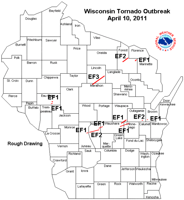
What happened April 10, 2011
The last time the weather service outlined this same region in a Moderate Risk for severe weather two days in advance was in April 2011. On April 8, 2011, the Storm Prediction Center put southeast Minnesota, eastern Iowa, far western Illinois and southwest Wisconsin in a Moderate Risk for severe weather, effective for April 10, 2011. At the time, the Storm Prediction Center used a three-category system of Slight, Moderate and High. (The five-category system we use now of Marginal, Slight, Enhanced, Moderate and High did not come into use until 2014.) This means this area was in a Level 2 out of 3 for severe weather. The storm system on April 10, 2011, went on to produce widespread severe weather, including a tornado outbreak of 15 tornadoes across the state of Wisconsin. One of those tornadoes was an EF3 with winds estimated between 130 and 140 miles per hour, and was on the ground for 21 miles. The tornado outbreak of April 10, 2011 still holds the record for the most tornadoes in one day during the month of April in Wisconsin.
Bottom Line: Forecasters expect a severe weather outbreak with large hail, damaging wind gusts and intense tornadoes across the upper Midwest Monday, April 28. A Moderate Risk of severe weather was outlined two days in advance for parts of Minnesota, Wisconsin and Iowa. Be weather-aware and stay updated with the forecast from a trusted source, such as the National Weather Service.
Like what you read?
Subscribe and receive daily news delivered to your inbox.
More from
Rachel Duensing


