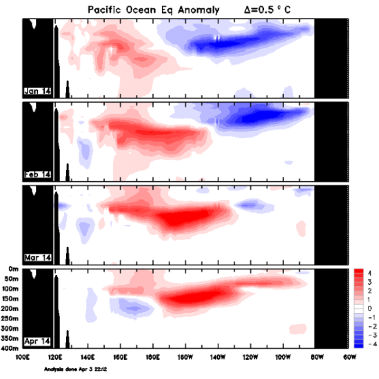
The giant red blob in this image is a huge, unusual mass of warm water that currently spans the tropical Pacific Ocean. Eric Holthaus, a meteorologist who writes about weather and climate for Slate, says the volume of water is big enough to cover the United States 300 feet deep. And that’s a lot of warm water, he says. Holthaus also says that, as the sub-surface warm water in the Pacific moves eastward – propelled by anomalous trade winds – it’s getting closer to the ocean’s surface. Once the warm water hits the sea surface, it will begin to interact with the atmosphere. Why? Because Earth’s oceans and atmosphere are always interacting. In this case, the warm water will likely boost temperatures and change weather patterns … and possibly bring on a monster El Nino in 2014. There are signs this is already beginning to happen. Read more at Slate.

By the way, the warm water just below the ocean’s surface this year is on par with that of the biggest El Niño ever recorded, in 1997-98. That event caused $35 billion in damages and was blamed for around 23,000 deaths worldwide.
Bottom line: Scientists are watching a giant mass of sub-surface water in the Pacific. When this water reaches the sea surface, it could set off a powerful El Nino in 2014.


