


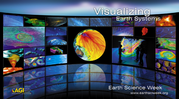
Earth Science Week is an event organized by the American Geosciences Institute to promote understanding and stewardship of the Earth. The theme of this year’s event is “Visualizing Earth Systems.” The event runs from October 11–17, 2015. There are several ways you can participate and share your enthusiasm for the Earth Sciences. Read on to find out how.
The Earth is composed of four key systems that shape our environment. These systems include the geosphere (land), hydrosphere (water), atmosphere (air), and biosphere (living organisms). Geoscientists study these systems to find out what they are composed of, how they interact, and how they are changing over time.
As part of this year’s Earth Science Week, three contests are being held to encourage people to reflect on how Earth systems interact and influence your local environment. There is a photography contest, a visual arts contest, and an essay contest. Submissions are due October 16, 2015. Head over to the AGI contest website here to find out how to enter.
There are also several local events scheduled for Earth Science Week. The National Park Service celebrates National Fossil Day in conjunction with Earth Science Week and has posted a listing of all such events on their website here. Many of these events will take place at local science museums.
You can also share your thoughts and photos about Earth Science on social media with the hashtag #EarthSciWeek. To get you inspired, check out the Visualizing Earth Systems website here.
This website contains excellent examples of how scientists are using state-of-the-art technologies to visualize Earth systems. Examples are provided for the areas of climate, energy, hazards, minerals, and water. Under the “minerals” category, there is a neat clickable map describing the geology of the Grand Canyon. Here’s a screenshot of this visualization.

Under the “water” category, check out “Earth: A Global Map of Wind, Weather and Ocean Conditions”; I pasted a screenshot at the top of this post, but you really need to view these maps in motion to get the full effect.
There are many more examples on the visualization website that I have yet to check out, but I am hoping to get through all of them later this week. Please feel free to leave me a comment about any of the visualizations that you thought were really compelling.
The American Geosciences Institute is a not-for-profit organization that was founded in 1948. It represents over 250,000 geoscientists.
Enjoying EarthSky? Sign up for our free daily newsletter today!
Bottom line: Earth Science Week is October 11–17, 2015. The event aims to promote understanding and stewardship of the Earth, and it is organized by the American Geosciences Institute. The theme of this year’s event is “Visualizing Earth Systems,” and the associated website is loaded with visualizations worth exploring.
Like what you read?
Subscribe and receive daily news delivered to your inbox.
More from
Deanna Conners


