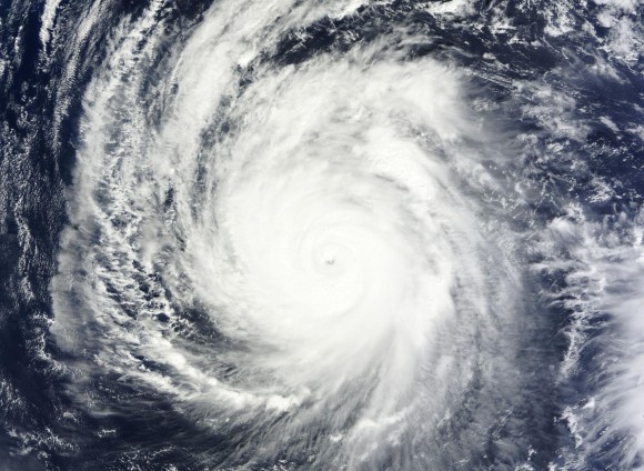
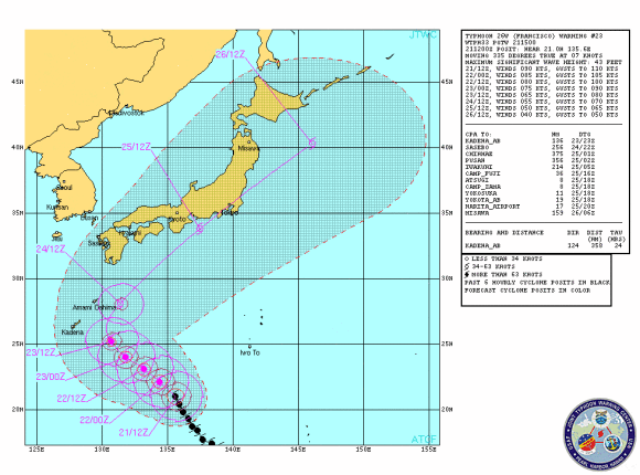
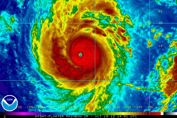
The 2013 typhoon season in the western Pacific continues to remain active, especially considering that it is the month of October. On October 18-19, 2013, Typhoon Francisco produced sustained winds around 160 miles per hour and was classified as the third-strongest tropical cyclone to have formed in 2013. Then, over the past 48 hours, Francisco was classified as a Super Typhoon. Francisco is now pushing to the north-northwest and will likely push into parts of eastern Japan by Friday, October 25, 2013 as a much weaker storm. Regardless, it will be the second system to strike Japan in about a week.
Japan will begin to see an increase in surf, rip currents, heavy rain, and gusty winds by the end of the week as Francisco pushes into the eastern parts of the country. Flooding is the main concern, especially since Japan was soaked from Typhoon Wipha last week.

October has been an extremely active month for tropical cyclones in the Western Pacific. Francisco is the sixth tropical cyclone to form in the month of October this year. The western Pacific Ocean typically averages around two tropical cyclones in the month of October. Last time we had such an active October of storms in the Western Pacific was back in 1995 when meteorologists recorded five named storms.

The forecast for Francisco is for the storm to continue pushing to the north-northwest and gradually weaken over time. It will likely hit Japan later this week as a tropical storm with winds around 50 knots (57 mph). Francisco will not be as strong as Typhoon Wipha when it hits Japan later this week. Wipha killed around 18 people as heavy rains resulted in flooding and mudslides. However, Francisco will produce heavy rains that could result in flooding across Japan.
The storm will move over cooler waters and will begin to transition from a tropical cyclone to an extratropical storm as a cold front absorbs the system. Best-estimate time period for Francisco to affect Japan is Friday, October 25, 2013.

Bottom line: Typhoon Francisco became the third-strongest cyclone to form on the Earth in 2013. Since it became such a powerful storm over this past weekend, Francisco is slowly weakening and will likely continue to weaken as it pushes over cooler waters and transitions from a tropical cyclone to an extratropical storm. Japan will begin to see an increase in surf, rip currents, heavy rain, and gusty winds by the end of the week as Francisco pushes into the eastern parts of the country. Flooding is the main concern, especially since Japan was soaked from Typhoon Wipha earlier last week.


