


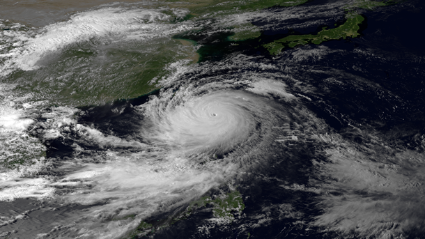
One of the strongest tropical cyclones in at least eight years has formed in the western Pacific Ocean and is moving toward Hong Kong. Categorized as a “super typhoon” at its peak on Thursday (September 19, 2013), Usagi swept through the Luzon Strait separating the Philippines and Taiwan on Saturday (September 21), bringing torrential rains and high winds to island communities. On Saturday morning, Usagi’s maximum sustained winds were at 139 mph with gusts exceeding 163 mph. A storm achieves super typhoon status when winds reach 150 mph. In other words, Usagi is weakening slightly.
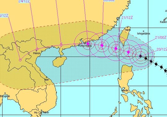
It is expected to impact Hong Kong by Sunday, September 22. Before it makes it to Hong Kong, Usagi is expected to weaken still more. Currently, it is a Category 4 storm with sustained winds near 140 mph. By the time it nears Hong Kong, the Joint Typhoon Warning Center expects the system to be a Category 1 or weak Category 2 storm with wind speeds around 90 to 100 mph. Regardless of how much this storm weakens, it will create heavy rains, flash flooding, and storm surge along the southeast coast of China.
On Thursday, at the storm’s peak, Usagi had sustained winds of 160 miles per hour, plus estimated wind gusts near 195 mph. Super Typhoon Usagi has been over very warm ocean waters as it has pushed to the west-northwest. With the wind speeds and pressure combined, Usagi is the strongest storm to have formed in 2013. The last time we saw a storm this strong was in 2005, when Major Hurricane Wilma formed as an extremely strong tropical cyclone in the Atlantic Ocean.

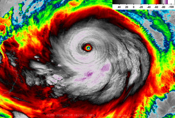
There have been reports that Super Typhoon Usagi is the strongest storm to have formed in the last 30 years. When they speak of “strongest” in this case, they are speaking in terms of Usagi’s barometric pressure. We measure the intensity of storms based on the barometric pressure. The lower the pressure, the stronger the storm. The strongest storm to form since people began measuring and tracking storms was Super Typhoon Tip. It formed in 1979 and had an estimated pressure of 870 millibars (mb). At its peak on September 19, Usagi had an estimated barometric pressure of 882 mb. The last time we had a super typhoon as strong as Usagi in the western Pacific was back in 1984 when Super Typhoon Vanessa had a pressure of 880 mb. However, Super Typhoon Megi in 2010 came very close to this with a pressure of 885 mb. All of these storms were super intense.
Bottom line: Super Typhoon Usagi is the the strongest cyclone so far in 2013. It is expected to weaken and impact parts of southeast China, in particular Hong Kong, by Sunday, September 22. Usagi could potentially slam Hong Kong with heavy rain, flash flooding, and strong winds.
Like what you read?
Subscribe and receive daily news delivered to your inbox.
More from
Matt Daniel


