


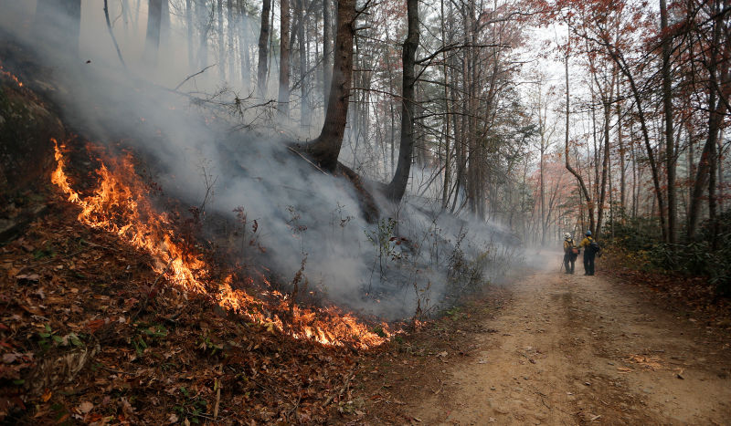
Dozens of wildfires across the southeast United States have burned an estimated 190 square miles (306 square km) and have thrown a shroud of smoke over the region in the past week or so. As of today (November 22, 2016) there are 44 large, uncontained fires burning in the South, according to national fire officials. Although firefighters have made progress on many of the fires, there is no end in site.
Most of the wildfires span northeast Alabama to eastern Kentucky, across the hills and mountains of the Southern Appalachians between Tennessee and North Carolina. Some of the fires are deep in the woods, while others threaten roads, buildings and homes.
On November 20. 2016, a NOAA/NASA satellite captured the above image of three fires that continue to blaze. Two of the fires – the Chestnut Knob fire and the Rock Mountain fire – are listed on the Inciweb site that keeps track of fires across the U.S. The third is an unnamed fire that doesn’t appear on either Inciweb or the GeoMAC wildfire viewer site and may have not yet been discovered or not yet reported to national authorities.

The Chestnut Knob fire began on November 6, 2016. Its cause is still under investigation. The fire has grown to 6,424 acres in size and as of today (November 22) is 40% contained. The Rock Mountain fire began on November 9, 2016 and was human-caused. Currently the fire is 11,287 acres in size and is 30% contained.
Unfortunately, the weather forecast for the region is for very low humidity and winds that could flame the fires and help them spread.
Wind gusts and lack of meaningful rainfall in over three months are making extinguishing these fire very difficult for firefighters.
Bottom line: Dozens of wildfires across the southeast United States have burned an estimated 190 square miles (306 square km) and have thrown a shroud of smoke over the region in the past week or so. As of today (November 22, 2016) there are 44 large, uncontained fires burning in the South, according to fire officials.
Like what you read?
Subscribe and receive daily news delivered to your inbox.
More from
Eleanor Imster


