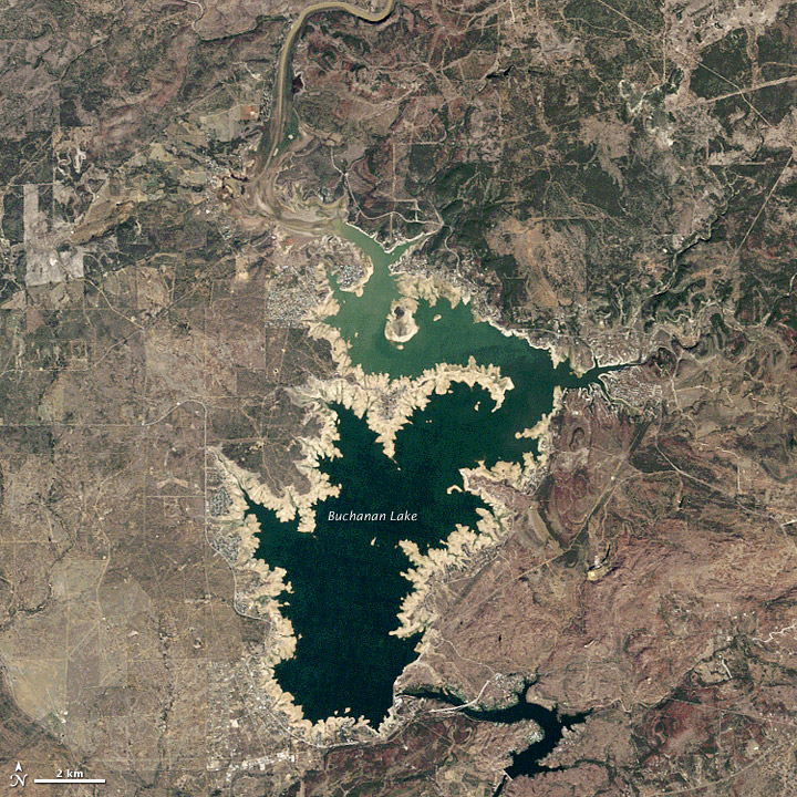
It has been hot and dry in Texas over this past year. September 2010 to September 2011 was the driest on record here. Although we’ve had some rain in central Texas in recent months, our lakes and rivers are still down, and the Texas Forest Service is saying the 2011 drought in Texas has killed some 10% of our trees. Today, NASA released before and after satellite images – before and after the devastating 2011 drought, that is – of one of Austin, Texas’ most beloved playgrounds, Lake Buchanan.


The Thematic Mapper on NASA’s Landsat 5 satellite captured these images of Lake Buchanan, Texas, in October 2011 and October 2003. NASA says that, despite the recent rain, by the morning of December 28, 2011, Lake Buchanan stood roughly 23 feet (7 meters) below its historic average for the month. And this is just one of the Texas lakes that’s suffering in this way from the drought. In fact … they’re all suffering.
NASA has a great write-up on Lake Buchanan and these images, which you can read here.
Bottom line: As 2012 opens, Texas is still dry. We’re holding our breath to see what this summer brings.


