


Bumpy flight: Clouds and air travel
Sure, there’s clear-air turbulence. But when your airplane ride gets bumpy, you’re likely to look out your window and see clouds. They might range from puffy cumulus clouds, aka fair-weather clouds, to monstrous cumulonimbus with their characteristic anvil-shaped tops, billowing sides and ominously dark bases. The fact is … clouds are cooler than the surrounding air. So it’s the contrast in density between clouds and the surrounding air that creates a sort of “pothole” in the sky, making for a less smooth ride.
Weather and aircraft performance
Mike Sueflohn has been a private and commercial pilot for more than 23 years. As a pilot, he must take part in recurrent training, where they discuss how weather relates to aircraft performance. Some of the issues they focus on are takeoffs, landings and concerns such as wind shear. Sueflohn told EarthSky:
Much of the weather, including turbulence, that we have when flying is derived by the sun and uneven heating of Earth’s surface. As a result, you can experience turbulence at any time. Normally, early in the morning and later in the evening and throughout the night you may find the best time for smooth rides.
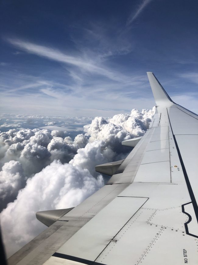
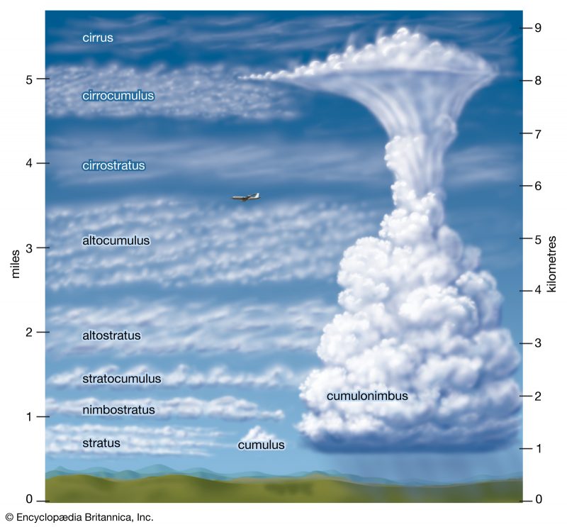
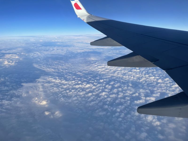
Most commercial airlines fly above much of the clouds, though they do still have to fly through them to get in and out of the airports. A typical commercial jet has a cruising altitude of around six to seven miles (nine to 11 km) above sea level. So on a long-distance flight, the plane will generally be above most clouds except for cirrus and the towering cumulonimbus.
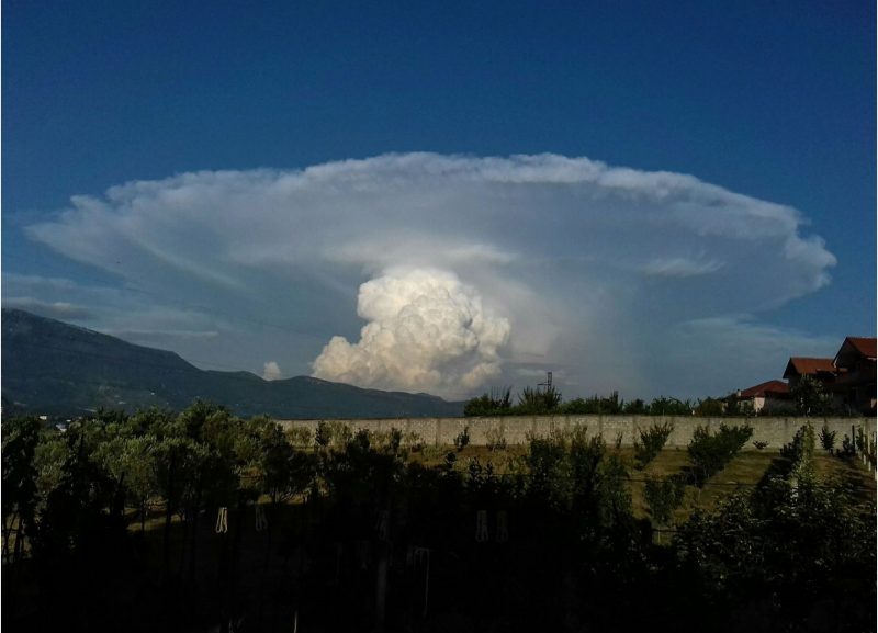
Cumulonimbus: Nature’s detour sign for planes can cause a bumpy flight
As you might guess, storm clouds – specifically cumulonimbus – are the types of clouds that pilots most want to avoid. Cumulonimbus clouds generally contain heavy rain, lightning, hail, strong winds and occasionally tornadoes. Pilots and air traffic control pay close attention to the weather and route flights around these types of storms. As Sueflohn said:
We respect and pay attention to the frontal boundaries where the potential for storm activity/energy exists. Clouds commonly associated with these boundaries that we concern ourselves with are cumulonimbus. Good decision making would be to consider alternate flight planning options where these conditions exist.
have you ever watched planes go around thunderstorms? it's pretty cool pic.twitter.com/wZohw41VwE
— J?seph Pa??on (@JosephPattonWx) April 14, 2022
Mammatus clouds
Another type of cloud associated with cumulonimbus is mammatus. Mammatus are bubbling pouches of air that hang below the base of a cloud. The website TheAirlinePilots said:
Airline pilots will normally take action to avoid any cumulonimbus clouds, but particularly those bearing mammatus formations, as these indicate especially severe turbulence within the cumulonimbus. Mammatus may be observed wherever cumulonimbus clouds occur, but it is particularly common in areas where thunderstorms are severe, such as tropical and subtropical areas. Because the formation is associated with mature cumulonimbus clouds, it is most likely to be seen from mid-afternoon to early evening, when ground heating and associated convective activity have reached a maximum.
Learn more about why pilots avoid cumulonimbus clouds in the video below.
Other types of clouds
All clouds are made of water droplets or ice crystals. Clouds come in a wide variety of types, from thin to thick and puffy and ranging from low to the ground to the top of the troposphere (and sometimes in the stratosphere. There’s even one type of cloud, called noctilucent clouds, that exist in the mesosphere). Air traffic control specialist Jeffrey Hormann told EarthSky how some of the different types of clouds can affect airplanes:
Cumulonimbus present the most hazards due to the turbulence along with all of the standard thunderstorm fare. Cumulus themselves represent a likelihood of turbulence in the updrafts below them, but smooth air above. Stratus often contain rime ice, especially at their tops, during the colder seasons. Fog and lower visibility restricts aircraft to flying instrument approaches into airports, which below minimum conditions (1/2 mile visibility and 200-foot cloud bases are common) the aircraft cannot continue to land.
Read more about some unusual cloud types:
Hole punch clouds are made by jets
Undulatus clouds look like wavy rows
Kelvin-Helmholtz clouds look like ocean waves
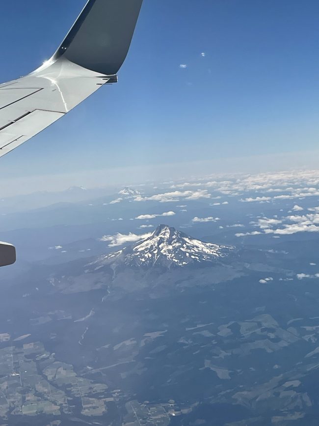
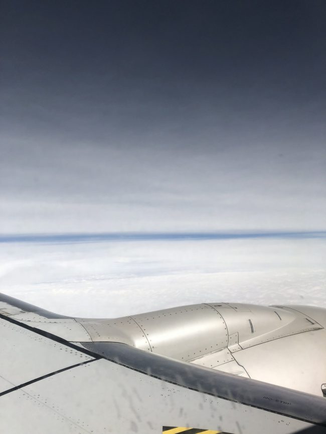
Cloud gallery from airplanes
Bottom line: Many types of clouds and even clear skies can produce a bumpy flight on an aircraft. But cumulonimbus are the most important clouds for airplanes to avoid.
Like what you read?
Subscribe and receive daily news delivered to your inbox.
More from
Kelly Kizer Whitt


