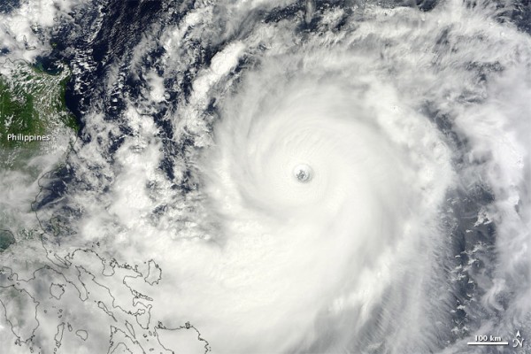
A week ago, Super Typhoon Sanba was listed as the most powerful tropical cyclone to develop across the globe for 2012 with maximum winds sustaining around 175 mile per hour (mph) at one point. Sanba pushed through parts of Okinawa, Japan and traveled into South Korea and dumped heavy rains across North Korea. Now, a week later, a new typhoon has formed and could impact Okinawa, Japan once again. Super Typhoon Jelawat is approximately 495 nm south-southwest of Kadena Air Base, Okinawa, Japan and is pushing to the northwest at five knots. As of now, Jelawat is considered a Category 4 hurricane on the Saffir Simpson scale with sustained winds around 155 mph and will likely push near Okinawa, Japan on Friday, September 28, 2012.

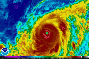
Super Typhoon Jelawat had a rapid burst of intensification on September 23, 2012 when it went from a tropical storm with 65 mph winds to a Category 4 typhoon with 140 mph winds in just 24 hours. Jelawat is pushing parallel of the Philippines and will provide rip currents and squally weather across the islands. Fortunately, the strong hurricane force winds will not impact the islands directly, and flooding will not be a huge concern. For now, the weather models are pushing Jelawat northwest with a more northerly track in time and will likely impact parts of Okinawa, Japan by Friday. The storm will likely maintain Category 4 intensity for the next 24 hours before it finally weakens late Thursday and Friday as a Category 2 storm. As of now, Jelawat could intensify back into a Category 5 storm with winds possibly exceeding 160 mph. As of now, Jelawat is showing very cold cloud tops, has a symmetrical appearance, and a defined 25 mile-wide eye that all indicates a very healthy tropical cyclone.
Bottom line: Super Typhoon Jelawat is a monster tropical cyclone producing winds around 155 mph. Jelawat could regain Category 5 status in the next six to twelve hours as it pushes across ideal conditions that favor some strengthening. Jelawat will continue to push to the northwest parallel of the Philippines and will then push to the north/northeast and could impact Okinawa, Japan sometime on Friday, September 28, 2012 as a weaker cyclone with an estimated intensity around the strength of a Category 2 storm.


