


Lightning from space
On July 3, 2023, the European Space Agency (ESA) released the first animations from their new lightning-tracking satellite. The lightning imager on the Meteosat Third Generation satellite marks the first time scientists have been capable of continuously detecting lightning across Europe and Africa.
The lightning imager has four cameras that cover Europe, Africa, the Middle East and parts of South America. The cameras can capture up to 1,000 images per second. These views give weather forecasters more data for their predictions. It’s particularly helpful in remote areas such as over oceans, where lightning detection was previously limited.
Key role in air traffic safety
One of the areas in which the new lightning observations will play a key role is in air travel. Lightning poses a real danger to an airplane’s onboard instruments. Phil Evans, with the European Organization for the Exploitation of Meteorological Satellites , said:
Severe storms are often preceded by abrupt changes in lightning activity. By observing these changes in activity, the lightning imager data will give weather forecasters additional confidence in their forecasts of severe storms.
When these data are used in conjunction with the high-resolution data from the Flexible Combined Imager, weather forecasters will be better able to track the development of severe storms and have a longer lead-in time to warn authorities and communities.
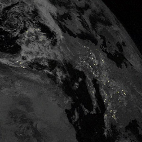
Videos of lightning from space
These two videos showcase what the new satellite can do. The first video shows the full view from the north camera, reaching from Europe across the Mediterranean and into Africa. Thunderstorms develop nearly daily around the Mediterranean during the warmer months.
The second video shows lightning over Central Africa, the most active lightning region in the world. This animation covers five days, as lightning flashed continuously and storms marched westward.
You can see more lightning animations from the new satellite here.
Bottom line: The European Space Agency has a new satellite that is capturing views of lightning from space. The satellite will help improve forecasts and make air travel safer.
Read more: Bumpy flight? Here’s how clouds affect air travel
Like what you read?
Subscribe and receive daily news delivered to your inbox.
More from
Kelly Kizer Whitt


