


NASA published this original article on April 5, 2023. Edits by EarthSky.
Both scientists and the public can navigate a new global image of the red planet from Caltech using data from NASA’s Mars Reconnaissance Orbiter (MRO).
Last chance to get a moon phase calendar! Only a few left. On sale now.
New Mars map
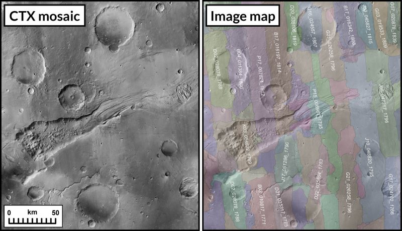
Users can see cliffsides, impact craters and dust-devil tracks in mesmerizing detail in a new mosaic of the red planet. Overall, the mosaic consists of 110,000 images from MRO. The veteran spacecraft’s black-and-white Context Camera (CTX) captured the images, which cover nearly 270 square feet (25 square meters) of surface per pixel.
That makes the Global CTX Mosaic of Mars the highest-ever-resolution global image of the red planet. Indeed, if you were to print it out, this 5.7 trillion pixel (or 5.7 terapixel) mosaic would be large enough to cover the Rose Bowl Stadium in Pasadena, California.
The product of Caltech’s Bruce Murray Laboratory for Planetary Visualization, the mosaic took six years and tens of thousands of hours to develop. In fact, it is so detailed that more than 120 peer-reviewed science papers have already cited a beta version. But the mosaic is also easy enough for anyone to use.
Making Mars accessible to everyone
Jay Dickson is the image processing scientist who led the project and manages the Murray Lab. He said:
I wanted something that would be accessible to everyone. Schoolchildren can use this now. My mother, who just turned 78, can use this now. The goal is to lower the barriers for people who are interested in exploring Mars.
CTX is among three cameras aboard MRO, which is led by NASA’s Jet Propulsion Laboratory in Southern California. One of those cameras, the High-Resolution Imaging Science Experiment (HiRISE), provides color images of surface features as small as a dining room table.
In contrast, CTX provides a broader view of terrain around those features, helping scientists understand how they’re related. Moreover, its ability to capture larger expanses of the landscape has made CTX especially useful for spotting impact craters on the surface. A third camera, the Mars Color Imager (MARCI), led by the same team that operates CTX, produces a daily global map of Mars weather at much lower spatial resolution.
Mars up close
Snapping away since MRO arrived at Mars in 2006, CTX has documented nearly all of the red planet. Therefore, its images are an optimal starting point for scientists when they’re creating a map. A bit like hunting for a needle in a haystack and putting together a puzzle at the same time, mapmaking requires downloading and sifting through a large selection of images to find those with the same lighting conditions and clear skies.
To create the new mosaic, Dickson developed an algorithm to match images based on the features they captured. He manually stitched together the remaining 13,000 images that the algorithm couldn’t match. The remaining gaps in the mosaic represent parts of Mars that hadn’t been imaged by CTX by the time Dickson started working on this project. The gaps are also areas obscured by clouds or dust.
New Mars map helps scientists
Laura Kerber, a Mars scientist at JPL, provided feedback on the new mosaic as it took shape. Kerber said:
I’ve wanted something like this for a long time. It’s both a beautiful product of art and also useful for science.
Kerber recently used the image to visit her favorite spot on Mars. Medusae Fossae is a dusty region about the size of Mongolia. Scientists are unsure exactly how it formed. Kerber, however, has proposed it might be a pile of ash from a nearby volcano. Now, at the click of a button on the CTX mosaic, she can zoom in and admire ancient river channels, now dry, winding through the landscape there.
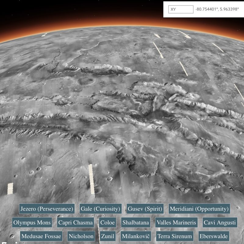
Gale Crater, Olympus Mons and beyond
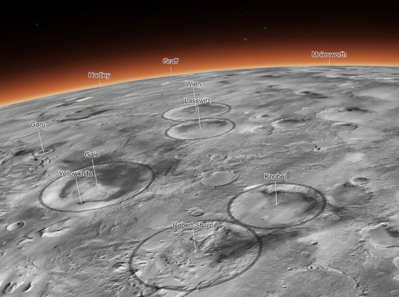
In addition, users can also jump to regions like Gale Crater and Jezero Crater. These are places that NASA’s Curiosity and Perseverance rovers are exploring. Users can also visit Olympus Mons, the tallest volcano in the solar system, adding topographic data from NASA’s Mars Global Surveyor mission. Likewise, one of the mosaic’s coolest features highlights impact craters across the entire planet, allowing viewers to see just how scarred Mars is.
Rich Zurek of JPL is the mission’s project scientist. He said:
For 17 years, MRO has been revealing Mars to us as no one had seen it before. This mosaic is a wonderful new way to explore some of the imagery that we’ve collected.
Bottom line: A new Mars map mosaic lets scientists and the public alike zoom in on surface features on the red planet.
Like what you read?
Subscribe and receive daily news delivered to your inbox.
More from
EarthSky Voices


