Question: What’s better than looking at satellite imagery of powerful hurricanes?
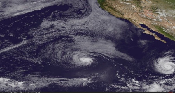
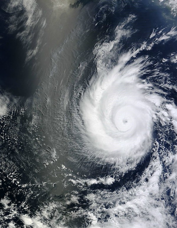
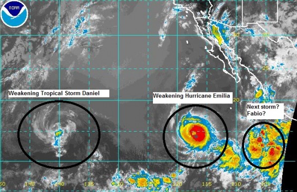
Answer: Knowing they are harmless storms that will not affect anyone. The 2012 Eastern Pacific hurricane season has been heating up lately as areas of low pressure have been developing this past week. Two named storms have already formed and peaked in intensity: Hurricane Daniel and Hurricane Emilia. Hurricane Daniel, the third hurricane of the 2012 eastern Pacific hurricane season, generated over this weekend and peaked in intensity with sustained winds of 115 miles per hour. Hurricane Emilia, which formed into the fourth hurricane of the 2012 Eastern Pacific Hurricane season on July 9, 2012, became much stronger with sustained winds of 140 mph (Category 4 storm). Check out these amazing satellite images taken by NASA of these violent, yet harmless storms.


As of now, Daniel and Emilia are still spinning over the eastern Pacific Ocean, but as they move northwest away from any land areas, they will encounter colder sea surface temperatures and should weaken and eventually dissipate. Meanwhile, another system located 475 miles south of Manzanillo, Mexico could develop later today and could become “Fabio” within the next few days as it moves across the open waters of the eastern Pacific ocean.

Bottom line: Amazing satellite images of two named storms in the Eastern Pacific Ocean: Hurricanes Daniel and Emilia. These “twin” storms formed over warm waters of the eastern Pacific ocean and pushed northwest away from any land areas. These storms are beautiful to look at on satellite imagery. What makes it even better is that these storms are not going to affect any land areas or populations. The sixth named storm “Fabio” could form in the next couple of days, and the National Hurricane Center gives this system a 80% chance to become a tropical depression in the next 24 to 48 hours. It is unknown as of now on whether or not this system will impact anyone along the coast of Mexico.


