


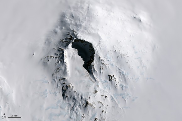
A chain of volcanoes along a 900-kilometer (560-mile) stretch of Antarctica’s Pacific coast, similar in size to the Cascade volcanic chain in North America, is home to Antarctica’s tallest volcano — Mount Sidley. The Landsat 8 satellite acquired these images of this volcano on November 20, 2014.
Enjoying EarthSky? Sign up for our free daily newsletter today!
The volcano – not to be confused with Vinson Massif, Antarctica’s tallest mountain – stands about 4,200 meters (13,800 feet) above sea level and 2,200 meters (7,200 feet) above ice level. The wall of the caldera – the cauldron-like feature formed by the collapse of land following an eruption – mostly shadowed in this image, is about 1,200 meters (3,900 feet) high. The caldera floor spans 5 kilometers (3 miles).
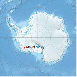
According to the USGS Geographic Names Information System, Rear Admiral Richard E. Byrd discovered the volcano during a flight on November 18, 1934. He later named the mountain after Mabelle E. Sidley, the daughter of a contributor to the Byrd Antarctic Expedition.
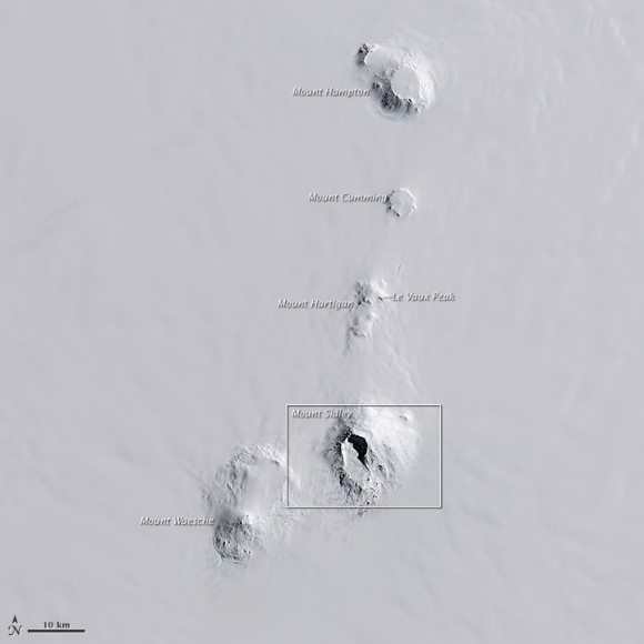
Sidley is one of five volcanoes in the Executive Committee Range (above image), which stretches about 80 kilometers (50 miles) from north to south. The range was discovered during a flight by the United States Antarctic Service on December 15, 1940, and it is named for the Service’s Executive Committee. Mount Sidley is the only mountain in the range not named for a committee member.
Mount Sidley is the youngest volcano in the Executive Committee Range to rise above the ice sheet. Below the ice sheet, however, seismologists have detected new volcanic activity 30 miles from Sidley, according to a 2013 news report .
Bottom line: Satellite view of Mount Sidley, tallest volcano in Antarctica, on the Pacific coast of Earth’s southernmost continent.
Like what you read?
Subscribe and receive daily news delivered to your inbox.
More from
Editors of EarthSky


