


Friday, September 6, 2013: Tropical Storm Gabrielle, which formed late Wednesday evening (September 4), has now has dissipated into a tropical wave of showers and thunderstorms.
Gabrielle is the seventh named storm of the 2013 Atlantic Hurricane Season. Convection has persisted across the Lesser Antilles over the past several days, and an area of low pressure was able to ramp up and organize to become a 40 mile per hour tropical storm. As of this morning (September 6), the system has lost the characteristics of a tropical cyclone, and is currently an open wave of showers and thunderstorms. Gabrielle will provide heavy rains and potential flooding across Puerto Rico as it pushes to the northwest.
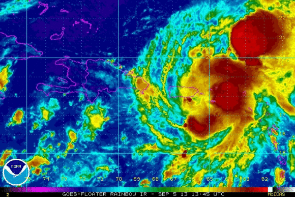
At the 11 p.m. EDT advisory on Thursday, September 5, 2013, the National Hurricane Center downgraded Gabrielle from a tropical depression to a remnant low/open wave. Pressures were going up as ex-Gabrielle continued to spin around Puerto Rico. It is providing heavy rains and could produce possible flash flooding across the region. The remnants of Gabrielle will likely travel to the north and could impact Bermuda by early next week. It is also possible that at that point, ex-Gabrielle will no longer exist and thus not be an issue.

Bottom line: Tropical Storm Gabrielle formed Wednesday evening but has been weakened into an open wave and is no longer a tropical cyclone as conditions have been unfavorable for strengthening. The only threat that lingers with this system is across Puerto Rico, U.S. Virgin Islands, and Hispaniola as it will produce heavy rain and possible flash flooding.
Like what you read?
Subscribe and receive daily news delivered to your inbox.
More from
Matt Daniel


