


A pileus cloud is a sign of bad weather
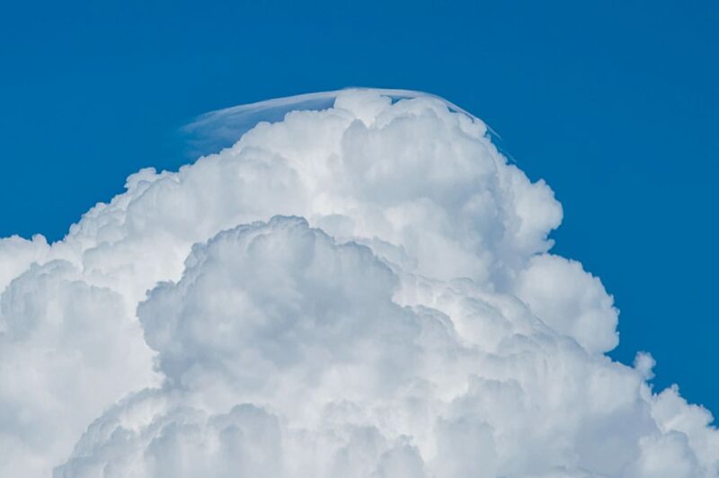
Have you ever seen a bubbling, towering cloud wearing a curved white cap on its head? These cap clouds – or pileus clouds – are a sign of bad weather. They form above vigorously growing cumulus or cumulonimbus clouds. If you see one, be prepared for storms.
Cumulus clouds are serene, fluffy clouds. When most people are asked to draw a cloud, a cumulus cloud is the kind they will sketch. Cumulus clouds can start as fair-weather clouds, but if conditions are right, they can become cumulonimbus clouds, or thunderheads. In a moist, unstable atmosphere, updrafts can cause cumulus clouds to grow, blossoming into the giant cauliflower shapes of cumulonimbus. Their bases grow dark as they grow thicker, because sunlight cannot penetrate them.
As these towering clouds push higher and higher into the atmosphere, they can bump into a stable layer of humid air. As the cloud continues to billow upward, it lifts that humid air above its dew point. The dew point is the temperature the air must cool to in order to become saturated with water vapor. At this point, the air cannot hold more moisture, so it condenses into clouds, resulting in the curved cloud cap on top of the thunderhead.
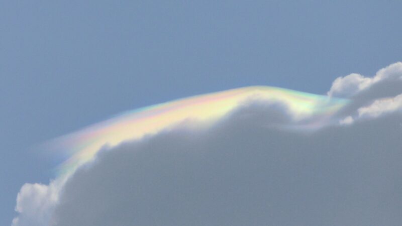
If you see one, snap a pic, because they won’t last long! The rising air continues its upward motion, mixing the air and merging the cap with the growing cloud.
More pics of pileus clouds
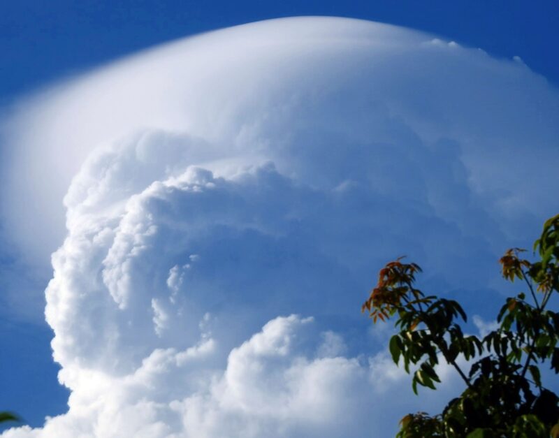
Bottom line: A pileus cloud looks like a curved, white cap on the top of a towering cumulus cloud. Pileus clouds are a sign that bad weather is on the way.
Read more: Cloud shapes are a useful tool for predicting weather
Read more: What are hole-punch clouds, aka fallstreak holes?
Like what you read?
Subscribe and receive daily news delivered to your inbox.
More from
Kelly Kizer Whitt


