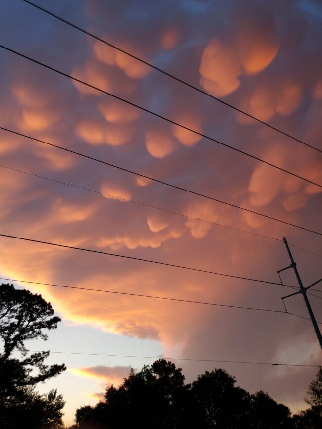
Mammatus clouds are pouch-like protrusions hanging from the undersides of clouds. You’ll usually find them under thunderstorm anvil clouds, but you might see them under other clouds as well. They’re composed primarily of ice. And groups of them can extend hundreds of miles in any direction. But they’re fleeting, remaining visible in your local sky for perhaps 10 or 15 minutes at a time.
Most clouds are formed by rising air. But mammatus clouds are formed by sinking air. They appear ominous.
People associate these cloud pouches with severe weather. And it’s true; they typically appear before or after a storm. But, in a way that’s so common in nature, their dangerous aspect goes hand-in-hand with a magnificent beauty. Enjoy the pictures below.
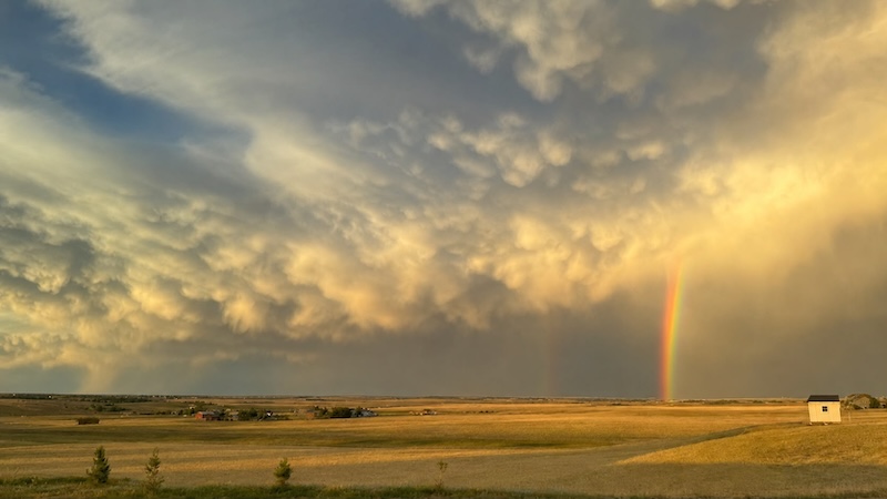
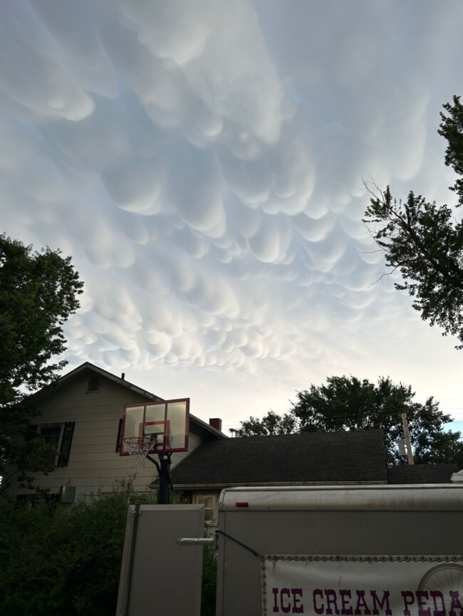
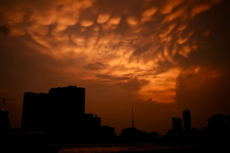
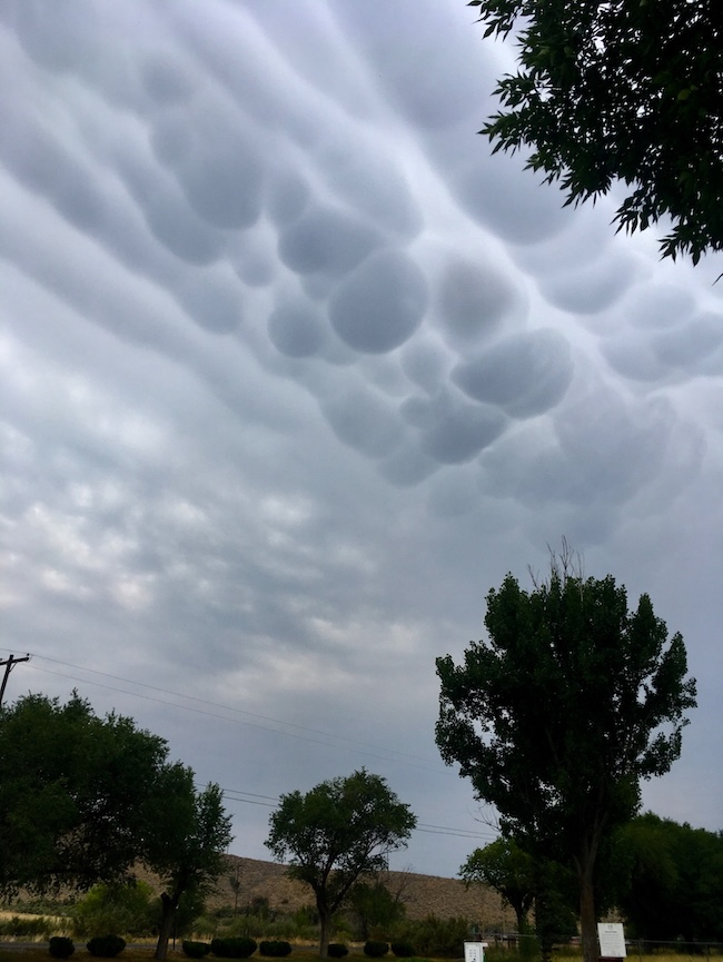
View at EarthSky Community Photos. | EarthSky’s own Marcy Curran captured this dramatic sky scene on July 9, 2026, in Cheyenne, Wyoming. Marcy wrote: “What a view – mammatus clouds and a partial double rainbow tonight.” Amazing! Thank you, Marcy.View at EarthSky Community Photos. | Deb King in Moundridge, Kansas, took this spectacular photo of mammatus clouds on June 10, 2026. Thank you, Deb!View at EarthSky Community Photos. | Vermont Jr. Coronel captured this photo from the Philippines on May 28, 2026, and wrote: “Mammatus clouds after the sudden thunderstorm on a very hot late afternoon. Thunderstorms are prevalent now in the Philippines during afternoon. A sign that the rainy season is about to begin.” Thank you, Vermont!View at EarthSky Community Photos. | Aaron Watson captured this image on July 17, 2025, from Colorado and wrote: “Interesting mammatus clouds this morning. It looked like long, deep grooves across the sky.” Thank you, Aaron!
More from our Community photos
View at EarthSky Community Photos. | Michael O’Connor captured this image on July 12, 2025, from Michigan and wrote: “Mammatus clouds. First time ever seeing them.” Thank you, Michael!View at EarthSky Community Photos. | Lina Tomlin in Texarkana, Texas, photographed these mammatus clouds on April 29, 2024. Lina wrote: “Stepped outside and my jaw dropped. I loved watching this massive storm cell roll by. I saw more ‘bubble’ clouds appear, and as the sun went down they lit up. I’ve never been this close to clouds like that. Thrilling!” Thank you, Lina!
Bottom line: Mammatus clouds look like bubbling, low-hanging clouds. They’re often associated with thunderstorms. Learn more about them and see photos here.
Deborah Byrd (asteroid 3505 Byrd) helps edit EarthSky.org and is a frequent host of EarthSky videos. Deborah created the EarthSky radio series in 1991 and founded EarthSky.org in 1994. Prior to that, she had worked for the University of Texas McDonald Observatory since 1976, and created and produced their Star Date radio series. She has won a galaxy of awards from the broadcasting and science communities, including having an asteroid named in her honor in 1990, a Public Service Award from the National Science Board in 2003, and the Education Prize from the American Astronomical Society in 2020. A science communicator and educator since 1976, Byrd believes in science as a force for good in the world and a vital tool for the 21st century. "Being an EarthSky editor is like hosting a big global party for cool nature-lovers," she says.
Like what you read? Subscribe and receive daily news delivered to your inbox.
Thank you! Your submission has been received!
Oops! Something went wrong while submitting the form.
If EarthSky has ever helped you discover something new, prepare for an eclipse, spot a planet, or simply inspired a moment of wonder, today is the perfect day to give back. Your donation helps keep trusted science news, expert night sky guides, and independent science journalism free for everyone.
Please help keep EarthSky going by donating today!
Please help keep
EarthSky going!
If you've already donated, we apologize for the popup and greatly appreciate your support.