


UPDATE JUNE 13, 2013: A fast-moving storm system did strike hard in the upper U.S. Midwest on Wednesday evening, June 12, 2013. As reported by CNN, Chicago – the Windy City – experienced wind gusts of 50 mph around 6 p.m. (7 p.m. ET), in addition to dime-size hail. Many other communities were hit as well. The storm moved quickly past Chicago, toward the east. Severe weather for Thursday, in the video below:
The risk for the storm was reported in advance. The story below is from earlier in the day on June 12.
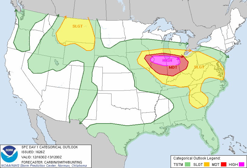
JUNE 12, 2013: A very strong area of low pressure associated with a cold front situated along the U.S. Midwest today (June 12, 2013) will trigger a significant round of severe storms capable of producing tornadoes, large hail, frequent lightning, and a large threat for strong, damaging winds gusting to over 80 miles per hour in some spots. The Storm Prediction Center has issued a rare high risk for severe thunderstorms that includes extreme eastern Iowa, northern portions of Illinois and Indiana, and parts of Northwest portions of Ohio. The last time a high risk was issued was on April 14-15, 2012. Nearly 12 million people are included in the high risk, which includes the cities of Chicago, Ottawa, and Fort Wayne. A moderate risk includes the cities of Indianapolis, Springfield, and Columbus. If you live in any of these areas today, you need to be prepared for a violent wind threat that could produce widespread damage and could affect millions of people.
Here are the highlighted risk areas:
Wind threat:

Winds will be the biggest worry as a line of storms will likely develop and bow out producing widespread damaging winds. There has been quite a number of meteorologists talking about the possibility for these storms to develop into a derecho. A derecho is a violent storm system that can produce widespread wind damage across a large area and is associated with a band of rapidly moving band of showers and thunderstorms. Could a derecho form? It is very possible, but as of right now, there still is some uncertainty as to whether or not that will truly happen. Regardless, if a severe thunderstorm warning has been issued, you need to take cover, especially if 80 mile per hour winds occur with this system.
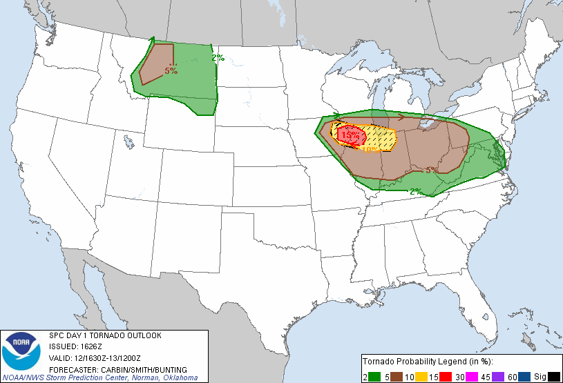
Tornado Threat:
Hail Threat:

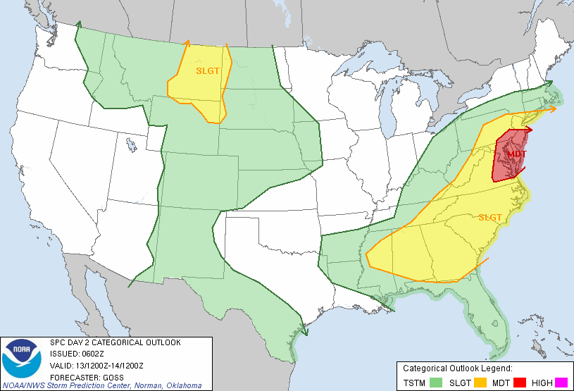
The severe weather threat will continue as this cold front pushes to the south and east. If you live in the Mid-Atlantic, be aware that a high wind threat could develop on Thursday (June 13) as this mass of storms that develops tonight will be pushing into the Washington D.C. area then.
Bottom line: Parts of the U.S. Midwest and stretching into the Mid-Atlantic states will experience a substantial severe weather outbreak on June 12, 2013 with dangerous winds the main concern. A tornado threat is also possible across these regions, and everyone should take severe thunderstorm and tornado warnings very seriously. Be safe if you live in these regions, and you might want to bring in anything that could fly away easily outside.
Like what you read?
Subscribe and receive daily news delivered to your inbox.
More from
Matt Daniel


