- Climate change is outpacing our understanding of extreme weather, making it harder to predict future conditions accurately.
- Climate statistics are outdated as global temperatures rise, leading to unpredicted severe weather events.
- Accuracy of models used to anticipate weather extremes is uncertain in today’s rapidly shifting climate.
By Simon H. Lee, University of St Andrews; Hayley J. Fowler, Newcastle University, and Paul Davies, Newcastle University
We haven’t seen how bad extreme weather could get
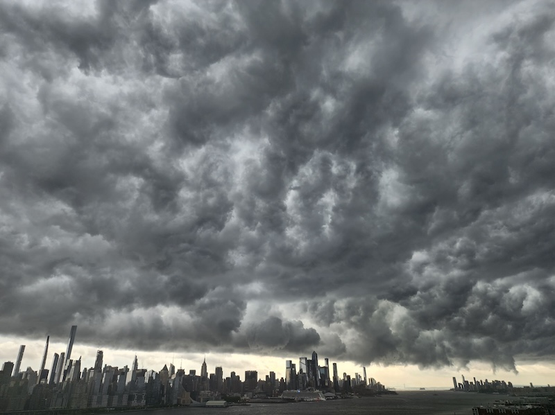
Extreme weather is, by definition, rare on planet Earth. Ferocious storms, searing heatwaves and biting cold snaps illustrate what the climate can do, at its worst. But in the 21st century, as Earth’s climate rapidly warms, the range of possible weather conditions, including extremes, is changing.
Scientists define “climate” as the distribution of possible weather events observed over a length of time, such as the range of temperatures, rainfall totals or hours of sunshine. From this they construct statistical measures, such as the average (or normal) temperature. Weather varies on several timescales – from seconds to decades – so the longer the period over which the climate is analyzed, the more accurately these analyses capture the infinite range of possible configurations of the atmosphere.
Typically, meteorologists and climate scientists use a 30-year period to represent the climate, which is updated every ten years. The most recent climate period is 1991-2020. The difference between each successive 30-year climate period serves as a very literal record of climate change.
This way of thinking about the climate falls short when the climate itself is rapidly changing. Global average temperatures have increased at around 0.2°C (0.36°F) per decade over the past 30 years, meaning that the global climate of 1991 was around 0.6°C (1.08 F) cooler than that in 2020 (when accounting for other year-to-year fluctuations), and even more so than the present day.
Check out this conversation on climate chaos with meteorologist and climatologist Daniel Swain. It was one of EarthSky’s most-viewed livestreams yet … now available as a replay.
A moving target for climate modelers
If the climate is a range of possible weather events, then this rapid change has two implications. First, it means that part of the distribution of weather events comprising a 30-year climate period occurred in a very different background global climate: for example, northerly winds in the 1990s were much colder than those in the 2020s in north-west Europe, thanks to the Arctic warming nearly four times faster than the global average. Statistics from three decades ago no longer represent what is possible in the present day.
Second, the rapidly changing climate means we have not necessarily experienced the extremes that modern-day atmospheric and oceanic warmth can produce. In a stable climate, scientists would have multiple decades for the atmosphere to get into its various configurations and drive extreme events, such as heatwaves, floods or droughts. We could then use these observations to build up an understanding of what the climate is capable of. But in our rapidly changing climate, we effectively have only a few years, not enough to experience everything the climate has to offer.
A perfect storm
Extreme weather events require what meteorologists might call a “perfect storm.” For example, extreme heat in the U.K. typically requires the northward movement of an air mass from Africa combined with clear skies, dry soils and a stable atmosphere to prevent thunderstorms forming which tend to dissipate heat.
Such “perfect” conditions are intrinsically unlikely, and many years can pass without them occurring, all while the climate continues to change in the background. Based on an understanding of observations alone, this can leave us woefully underprepared for what the climate can now do, should the right weather conditions all come together at once.
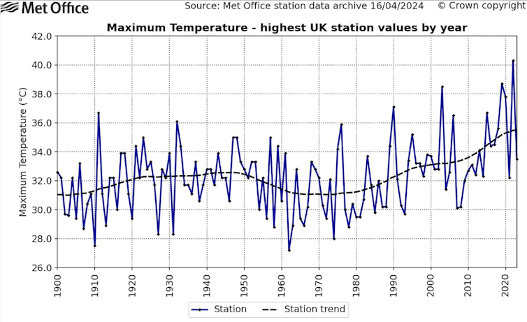
Startling recent examples include the extreme heatwave in the Pacific Northwest est of North America in 2021, in which temperatures exceeded the previous Canadian record maximum by 4.6°C (8.28 F). Another is the occurrence of 40°C (104 F) in the U.K. in summer 2022, which exceeded the previous U.K. record maximum set only three years earlier by 1.6°C (2.88 F). This is part of the reason why the true impact of a fixed amount of global warming is only evident after several decades, but of course – since the climate is changing rapidly – we cannot use this method anymore.
Playing with fire
To better understand these extremes, scientists can use ensembles: many runs of the same weather or climate model that each slightly differ to show a range of plausible outcomes. Ensembles are routinely used in weather prediction, but can also be used to assess extreme events which could happen even if they do not actually happen at the time.
When 40°C (104 F) first appeared in ensemble forecasts for the U.K. before the July 2022 heatwave, it revealed the kind of extreme weather that is possible in the current climate. Even if it had not come to fruition, its mere appearance in the models showed that the previously unthinkable was now possible. In the event, several naturally occurring atmospheric factors combined with background climate warming to generate the record-shattering heat on July 19 that year.
The highest observed temperature each year in the UK, from 1900 to 2023

Met Office/Kendon et al. 2024
Later in summer 2022, after the first occurrence of 40°C (104 F), some ensemble weather forecasts for the UK showed a situation in which 40°C (104 F) could be reached on multiple consecutive days. This would have posed an unprecedented threat to public health and infrastructure in the U.K. Unlike the previous month, this event did not come to pass, and was quickly forgotten, but it shouldn’t have been.
It is not certain whether these model simulations correctly represent the processes involved in producing extreme heat. Even so, we must heed the warning signs.
This year in the UK
Despite a record-warm planet, summer 2024 in the U.K. has been relatively cool so far. The past two years have seen global temperatures far above anything previously observed, and so potential extremes have probably shifted even further from what we have so far experienced.
Just as was the case in August 2022, we’ve got away with it for now, but we might not be so lucky next time.
Simon H. Lee, Lecturer in Atmospheric Science, University of St Andrews; Hayley J. Fowler, Professor of Climate Change Impacts, Newcastle University, and Paul Davies, Chief Meteorologist, Met Office and Visiting Professor, Newcastle University
This article is republished from The Conversation under a Creative Commons license. Read the original article.
Bottom line: Earth’s climate is now changing so rapidly that traditional meteorological forecasting models are failing to predict extreme weather.


