


Hurricane Polo explodes into a Category 5
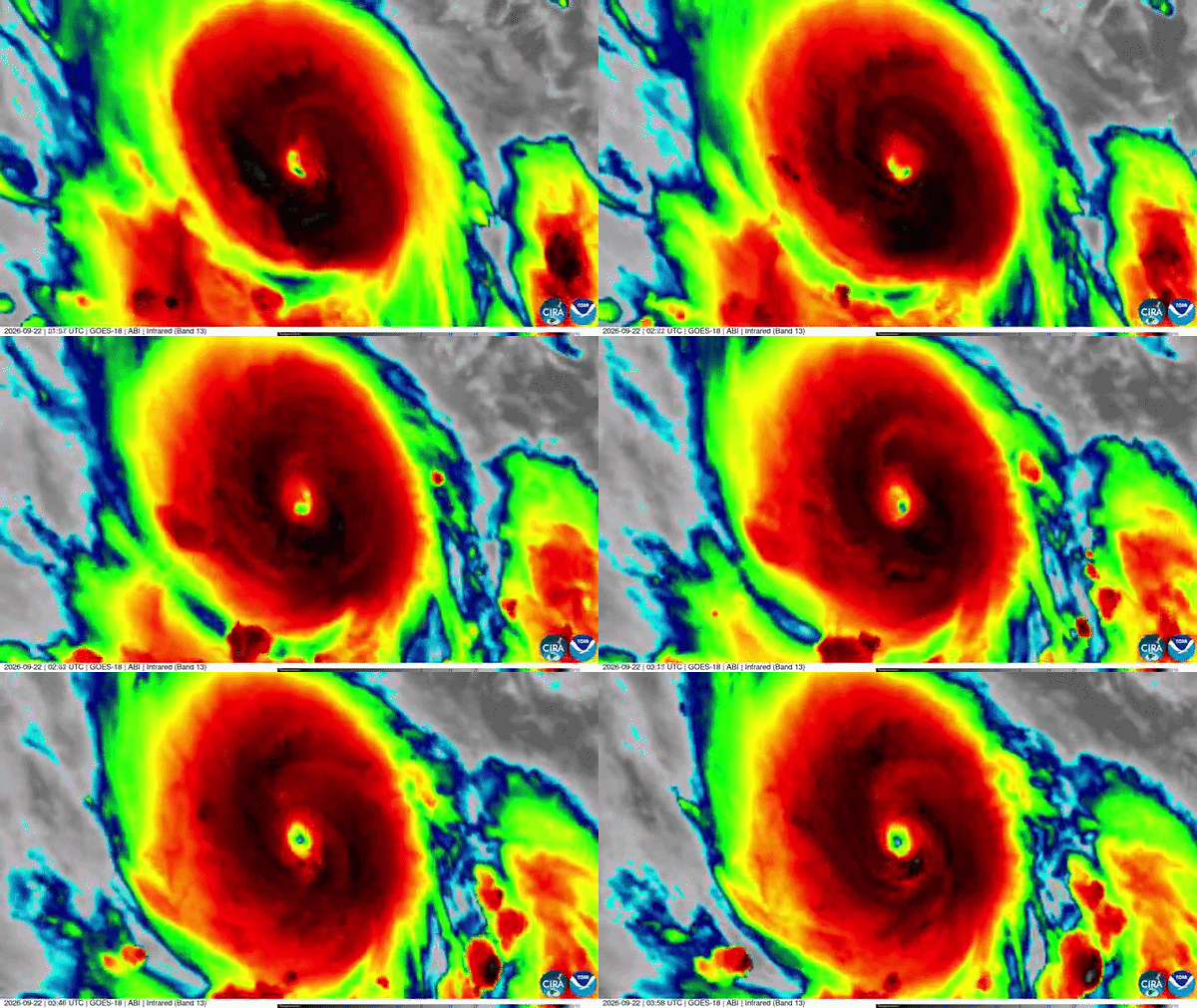
On Tuesday morning, September 22, 2026, Hurricane Polo reached Category 5 on the Saffir-Simpson scale. It’s churning just off the southwestern coast of Mexico, about 200 miles (328 km) southwest of Acapulco, with sustained winds of 160 mph (260 km/h). Just one morning prior, Polo was a tropical storm of just 45 mph.
The super-charged El Niño has brought warm waters to the eastern Pacific. In this region, sea-surface temperatures are around 88 F (31.2 C). This has helped Polo strengthen so quickly.
Only two hurricanes on record have ever undergone a more rapid intensification than Polo. One was Hurricane Patricia in 2015 and the other was an unnamed hurricane in 1957. You might also remember Hurricane Otis from 2023 that devastated Acapulco. That storm intensified at a similar rate as Polo.
Where is Polo headed?
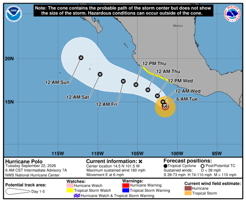
At the moment, Hurricane Polo is spinning off the shore of Mexico in the eastern Pacific. And for the rest of the week, the National Hurricane Center expects Polo to move slowly off the coast of Mexico. On Tuesday, Polo will head east, but by evening and on Wednesday it is forecast to take a sharp northwest and west-northwest turn. Currently, the forecast calls for Polo to remain offshore. However, the coast will feel tropical storm-force winds. Excessive rainfall is also a concern. The NHC said:
Polo is expected to produce rainfall totals of 4 to 8 inches, with isolated maximum totals up to 12 inches across coastal portions of the Mexican states of Guerrero and Michoacán through Thursday. This rainfall may produce life-threatening flooding and mudslides, especially in areas of steep terrain. Rainfall of 3 to 6 inches is possible in coastal portions of Oaxaca, Colima, and Jalisco through Thursday.
High waves and rip tides will also be a threat.
What happens next?
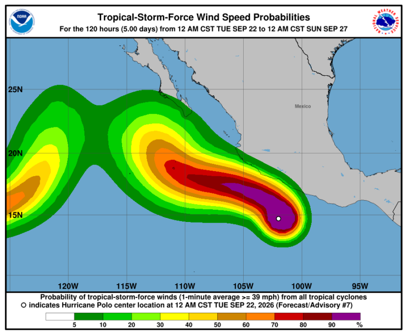
Where this storm will go by early next week is still unknown. Will it bring moisture to the American Southwest? As Yale Climate Connections said:
Long-range models suggest that steering currents will likely push Polo on a more north-northwest track by that point, and that could bring Polo into Baja California and push a surge of moisture toward northwest Mexico and the southwest United States.
But its true path is still unclear. And another low-pressure system, Tropical Storm Odalys, is just west of Polo. If they both hold up, they could meet in the next week.
Bottom line: Hurricane Polo has undergone rapid intensification just off the southwestern coast of Mexico. It went from a tropical storm to a category 5 hurricane in a day.
Like what you read?
Subscribe and receive daily news delivered to your inbox.
More from
Kelly Kizer Whitt


Fat Bear Week 2026: Here’s how to participate!

JUICE mission to fly by Earth next week! Details here
Forms of aurora: Arcs, curtains, coronas and more
Huge new Webb image is chock-full of space delights