


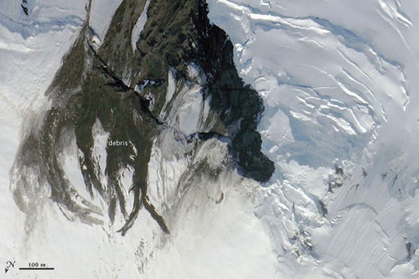

A magnitude-6.0 earthquake struck beneath Seward Glacier in northwestern Canada on July 17, 2014, and, by a lucky coincidence, NASA scientists, engineers, and pilots in nearby Fairbanks, Alaska were gearing up for near-daily flights over the area. They weren’t looking for landslides; they were developing processes for interpreting data from ICESat-2, a satellite scheduled for launch in 2017. Still, they were able to capture the image above of the July 17 landslide, apparently caused by the earthquake, which had obscured remnants of an older slide.
NASA said the team was already scheduled to make two flights near Seward Glacier in late July when a colleague back in Maryland alerted them to the earthquake, adding:
Their flight paths were taking them as close as 2 kilometers (1.2 miles) from the epicenter of the earthquake. Flights over the region just before and after the event provided an uncommon view of an earthquake’s effect on the snow-and-ice covered landscape.
NASA glaciologist Kelly Brunt, who helped acquire these images, said:
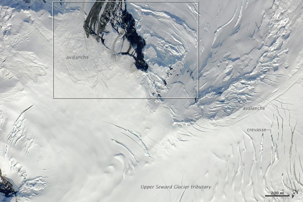
It’s obvious that many big debris and snow slides happened in this short time window. This is a super steep area, so you get a lot of activity here. The bulk of the activity in this case is probably associated with the July 17 quake.
Photos from the team suggest that the earthquake also might have prompted the draining of a supraglacial lake. Read more about the avalanche and possible draining of the lake at NASA Earth Observatory.
Bottom line: NASA scientists were in the right place at the right time this summer to captured photos of a fresh landslide, caused by an Alaska earthquake.
Like what you read?
Subscribe and receive daily news delivered to your inbox.
More from
Deborah Byrd


