


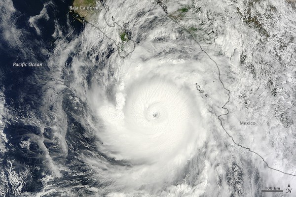
NASA’s Terra satellite acquired this natural-color view of Hurricane Odile around midday local time on September 14, 2014 when it was still southeast of the Baja California peninsula. Odile made landfall late that night as a Category 3 storm near Cabo San Lucas, Mexico. It was the first known storm to hit Cabo San Lucas as such a strong intensity. According to the U.S. National Hurricane Center, Odile struck Baja with wind speeds of 110 knots (204 kilometers or 127 miles per hour).
Read more: Major Hurricane Odile slams Baja Peninsula in Mexico
Like what you read?
Subscribe and receive daily news delivered to your inbox.
Thank you! Your submission has been received!
Oops! Something went wrong while submitting the form.
More from
Deborah Byrd
View All


Happy May Day! Today is an astronomy holiday
May 1, 2024
Why do we celebrate Earth Day on April 22?
April 21, 2024
Why does the moon seem to follow me when I’m in a car?
April 19, 2024
Kochab and Pherkad: Outer bowl stars of the Little Dipper
April 18, 2024


