


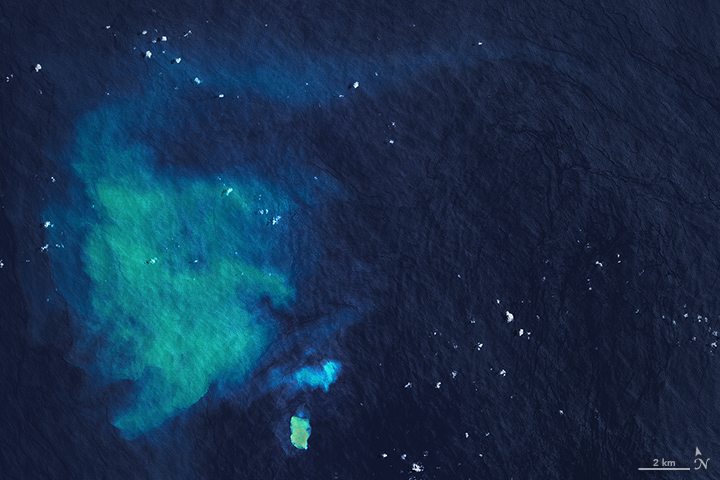
The turquoise plume of water in the satellite image above is coming from an underwater volcano in the midst of an eruption. The plume appears to have originated from a seamount that geologists call “Submarine Volcano III”, located 33 kilometers (20 miles) from Tonga’s main island of Tongatapu.
The satellite images above were captured on January 27, 2017. Other satellite images suggest that the eruption began on January 23, 2017. The discolored water was likely caused by the underwater release of gases, rocks, and volcanic fluids. The eruption also may have disturbed sediment on the seamount.
Martin Jutzeler is a University of Tasmania geologist who studies underwater eruptions. He said in a statement:
It may continue for some days or weeks, and an island may form temporarily. However, new volcanic islands are easily eroded by wave action.

Underwater eruptions aren’t uncommon in this area, which is part of the Tonga-Kermadec volcanic arc and the Pacific Ring of Fire. From an Earth Observatory statement:
Ash from volcanic eruptions on land are a well-known threat to airplanes, and underwater eruptions can likewise pose a hazard to ships. Some underwater eruptions produce rafts of light, porous rock called pumice that float on the sea surface and can clog ship engines.
Enjoying EarthSky? Sign up for our free daily newsletter today!
Bottom line: Satellite image of undersea volcano eruption near Tongatapu.
Like what you read?
Subscribe and receive daily news delivered to your inbox.
More from
Eleanor Imster


