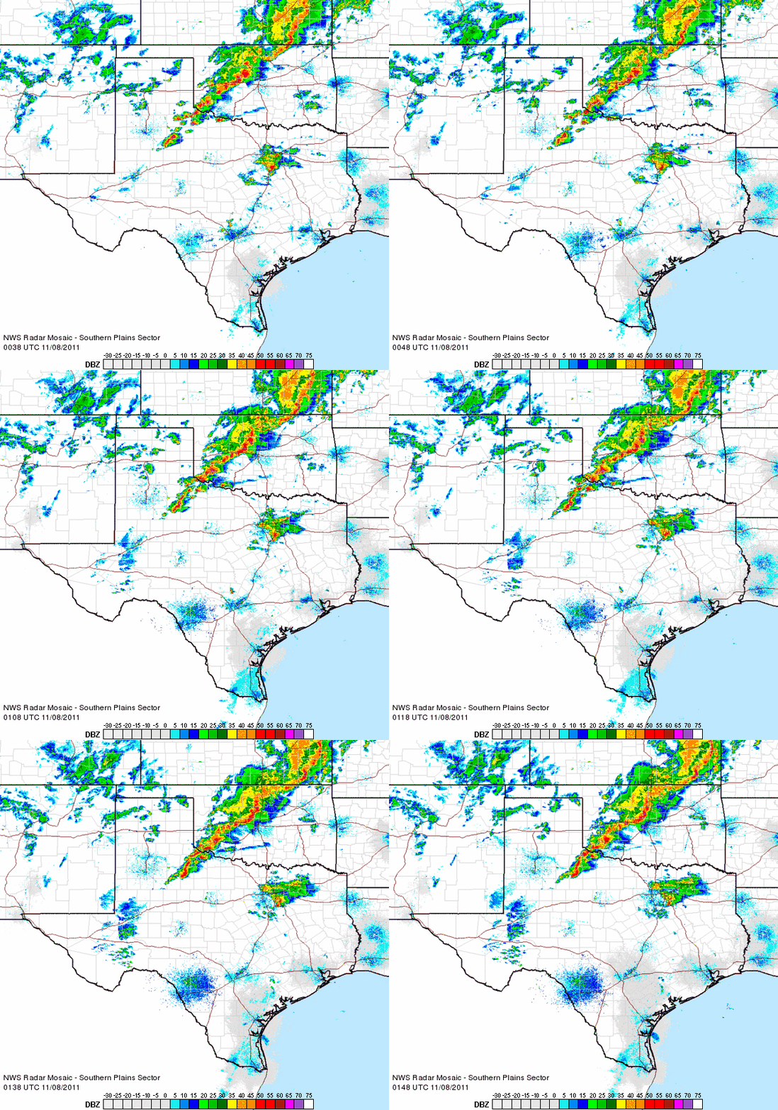
On November 7, 2011, a strong area of low pressure brought severe thunderstorms and localized flooding for portions of Texas and Oklahoma. The strongest storms occurred in southwest Oklahoma, where all of the parameters early in the day signaled chances for strong tornadoes in the area.
And tornadoes did strike. Many of the tornadoes that stuck portions of Oklahoma were in rural areas, but they did pack a punch.
Oklahoma is tornado country. According the National Weather Service from Norman, Oklahoma, the state averages 1.4 tornadoes in the month of November. However, the last time Oklahoma had tornadoes in November was back in 2008.
In 2011, the state of Oklahoma has seen its share of records caused by Mother Nature. This year, Oklahoma has experienced the coldest temperature (-31 F on February10, 2011), most snow in 24 hours (27 inches in Spavinaw on February 9, 2011), highest wind speed (150.8 miles per hour in El Reno on May 24, 2011), EF5 tornado, largest hail (six inches in diameter) and the strongest earthquake of 5.6. That earthquake was just this past weekend.
Stormchasers provided a lot of great images of the November 7 storms as they developed into supercell thunderstorms. One supercell thunderstorm went through various cycles on its journey to the northeast in southwest Oklahoma. At 3 p.m. CST, Doppler radar indicated a possible tornado pushing northeast into the city of Tipton, Oklahoma. In the image below, you can clearly see the hook on the southwest side of the storm indicating rotation in the system. Stormchasers confirmed that a large tornado was on the ground, and was moving to the northeast.
The tornado pushed into the the mesonet station in Tipton, Oklahoma. The mesonet simply records current weather conditions such as air pressure, temperature, moisture, and wind speeds. In the image below, you can clearly see a major drop in pressure shortly after 3 p.m. CST at this station. This was the exact time the tornado was moving into the area. It is worth noting that the mesonet did not respond after the tornado hit, with zero data pouring into the system. The tornado must have taken out the station.
Stormchaser Andy Gabrielson was after this supercell in Tipton, Oklahoma. In the video below, you can see Andy Gabrielson lose steering functions of his vehicle as outflow from the tornado probably pushed his vehicle a bit. Andy tweeted:
The accident WAS NOT due to the tornado my steering jammed up forcing me sideways while in reverse hit a ditch incline and it went over. Yes i am fine.
Andy is doing well and was actually picked up by stormchaser Reed Timmer from the show Stormchasers on the Discovery channel. This video is the reason no one should be on the roads during a tornado outbreak! Remember, those storm chasers have specially equipped vehicles.
Towards the end of its track, the storm came close to Alden, Oklahoma. Fortunately, by then, the system was weakening as it started to move more to the north instead of the northeast. The environment was becoming less susceptible for strong, long-lived tornadoes as individual supercells were growing in size and starting to form into a line of storms.
The individual storms became a linear system producing very strong winds. There was a report of a 81 mph wind gust two miles north-northwest of Perkins, Oklahoma at 8:30 p.m. These line of storms were moving rather slowly and producing very heavy rain. The National Weather Service at Norman, Oklahoma reported a swift water rescue going on at NW 122nd and Macarthur in Oklahoma City as a motorist was stuck in flooded vehicle. Around 8:45 p.m. , a 4.7 earthquake struck about 17 miles northeast of Shawnee, Oklahoma while the severe weather event was underway. Crazy!

The severe weather threat continues on November 8, 2011, but it should only become a wind threat as a line of storms pushes into Missouri, Arkansas, eastern Texas and Oklahoma and Louisiana. A few tornadoes are possible, but the ingredients for an outbreak of strong, large tornadoes are minimal.


