


September 25, 2013, 2 a.m. CDT (0700 UTC). The BBC is now reporting that at least 238 people died in a mountainous region of southwest Pakistan on Tuesday, when a powerful 7.7-magnitude earthquake struck there. The earthquake struck in Pakistan’s Balochistan region, its largest but least populated province. The quake was felt in the Indian capital Delhi, where some buildings shook. It caused a new island to rise from the sea, just off the Pakistan’s southern coast.
Most famous new island of 20th century is Surtsey. Read more.
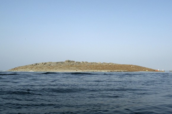
Television stations in the region were the first to report a small, mountain-like island. It is about 60 to 70 feet (18 to 21 meters) high, up to 300 feet wide and up to 120 feet long, according to Times of India, which also said it sits about 200 meters away from the coast. NBCNews.com reports that John Armbruster, a seismologist at the Lamont Doherty Earth Observatory at Columbia University, called the new island a “mud volcano.” It is apparently a jet of mud, sand and water that gushed to the sea surface following the earthquake. Nidhi Subbaraman of NBCNews.com wrote:
The shifting sand layers are compacted and pressurize the water, which gushed upwards, carrying mud and sand along with it.
This ‘liquefaction’ of sand and mud layers take place after any earthquake, but these sudden islands are usually spotted after strong earthquakes, at least 7- or 8-magnitude events.

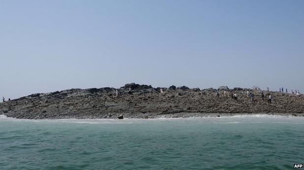
Earth is dynamic, and new islands do sometimes appear, often to slip beneath the waves again some time later. The image above is from 2010, when an island arose from the Arabian Sea off the southern coast of Pakistan. Older residents of the coastal town of Gwadar, Pakistan told NBCNews.com that a 1968 earthquake produced an island that stayed for one year and then vanished. Still earlier, an earthquake in this same region in the 1940s produced an island that was solid enough for people to walk on, but it washed away within weeks.
Details of the quake from the USGS are below:
Event Time
2013-09-24 11:29:48 UTC
2013-09-24 16:29:48 UTC+05:00 at epicenter
Location
27.016°N 65.547°E
Depth=15.0km (9.3mi)
Nearby Cities
69km (43mi) NNE of Awaran, Pakistan
115km (71mi) NW of Bela, Pakistan
171km (106mi) NW of Uthal, Pakistan
174km (108mi) S of Kharan, Pakistan
795km (494mi) ENE of Muscat, Oman
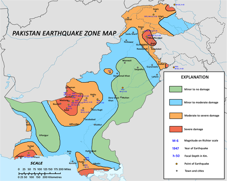
Large earthquakes are relatively common in Pakistan in contrast to other part of the world. Check out this list of Pakistan earthquakes from Wikipedia, and note that today’s earthquake is at least the third one since 2005 that measures 7.2 or greater on the Richter Scale. No fewer than four major tectonic plates (Arabia, Eurasia, India, and Africa) and one smaller tectonic block (Anatolia) are responsible for seismicity and tectonics in the Middle East and surrounding region, according to the USGS.
Bottom line: A large and powerful earthquake struck on September 24, 2013 in a remote, mountainous region of Pakistan. The quake measured 7.7 on the Richter Scale; that is a very large earthquake. It struck in Pakistan’s Balochistan region, its largest but least populated province. Reports are now suggesting that at least 238 people were killed in the quake. A new island formed from a “mud volcano” on the sea floor following the quake, according to scientists at the Lamont Doherty Earth Observatory at Columbia University.
Like what you read?
Subscribe and receive daily news delivered to your inbox.
More from
Deborah Byrd


