


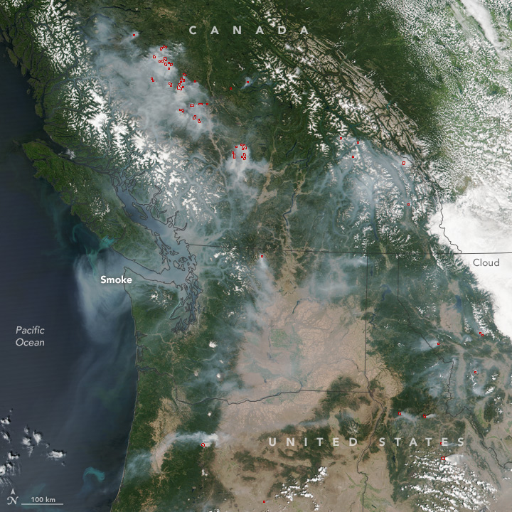
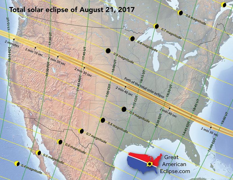
We’re hearing many reports, and getting some photos, of smokey skies in the Pacific Northwest, from both the U.S. and Canada. In fact, a map from NOAA’s Hazard Mapping System shows smoke across the entire U.S., eerily along the path of the August 21 total solar eclipse. The smoke is from wildfires burning in the U.S. and Canadian West. See maps below.
The National Interagency Fire Center (NIFC) said that weather will continue to “promote very active fire behavior.” Extreme high temperatures in the region are expected to contribute to unstable, dry conditions. As of August 9, the NIFC was reporting 40 large fires in the U.S., in California (10), Idaho (3), Montana (11), Nevada (1), Oregon (10), Washington (3) and Wyoming (1).
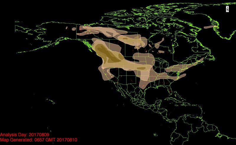
In the map above – which is GOES satellite data and is from NOAA’s Hazard Mapping System – you can see that smoke stretches across the whole U.S., but is densest in the Pacific Northwest.
Really smoky still here in Vancouver. ????
— Paul Scott Anderson (@paulsanderson) August 10, 2017
To the north, a significant amount of smoke is also coming from fires raging in western Canada. You can explore a smoke forecast for Canada (gives you a picture of what’s drifting southward) here.
We’ve also been getting photos of smoky suns from the EarthSky community, like the one below, which we posted to Facebook on August 7:
Bottom line: Smoke from wildfires stretches across the U.S. and is particularly dense in the Pacific Northwest. Some parts of the path of the total solar eclipse on August 21, 2017 could be affected by wildfire smoke.
Like what you read?
Subscribe and receive daily news delivered to your inbox.
More from
Deborah Byrd


