
Congratulations! You survived the end of the world, and Christmas is right around the corner. Time to focus on that popular question: will we have a white Christmas? Obviously, if you live farther north, the likelihood of seeing snow on the ground on Christmas Day is far greater than those who live in the deep south. In this post, we’ll define exactly the meteorological definition of a “white Christmas” and look at who in the U.S. and parts of Europe typically sees snow and who might see snow next week.
What is a white Christmas?
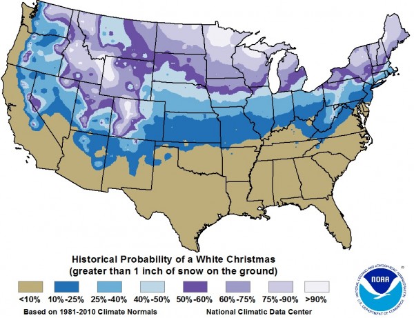
The definition of a white Christmas is simply waking up and seeing snow covering the ground. Snow does not have to fall on Christmas Day. There are various definitions that others use to define a “white Christmas”. Some people would argue that seeing just one snowflake fall from the sky on Christmas is enough to call it a white Christmas. NOAA defines a white Christmas for those places that see at least one inch of snow on the ground. If it snows on the 24th and sticks on the ground for the 25th, then you have yourself a white Christmas. For now, we will stick with the meteorological definition of a white Christmas. In the map above, NOAA and the National Climatic Data Center (NCDC) mapped out the chances of seeing at least one inch of snow on the ground based on climatology records from 1980-2010. Areas most likely to see snow or having decent odds of roughly 60% or better include much of the northern Rockies, the northern Great Plains, the Great Lakes area, and most of New England.
Who will see a white Christmas 2012?
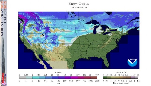
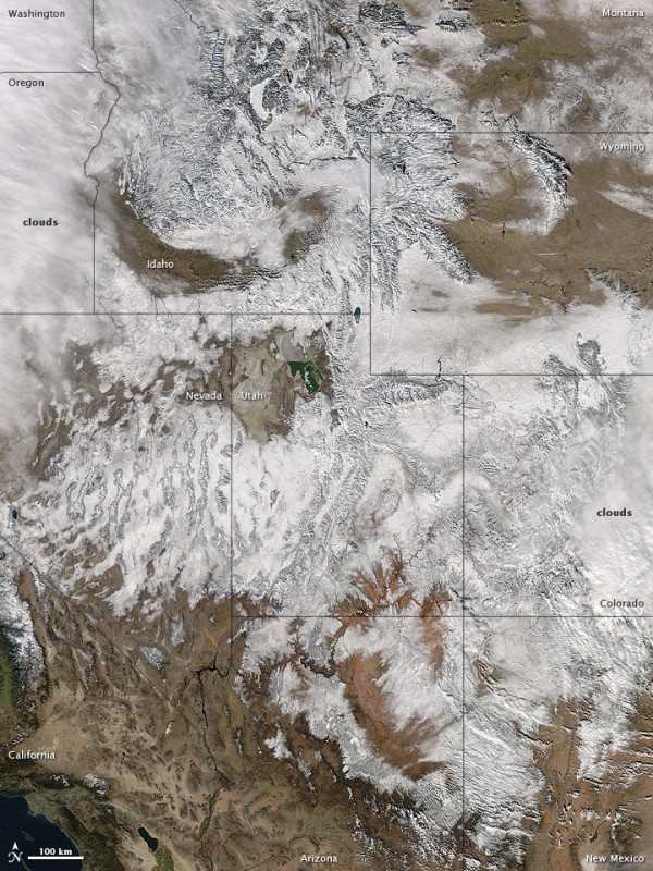
After a strong cold front has pushed through the United States, a large majority of the country is experiencing very cold temperatures. A large blizzard affected portions of the north-central United States. It pushed through parts of the Rockies and pushed eastward with blizzard conditions affecting Iowa and Wisconsin. Heavy snow and strong winds have knocked power out and caused major problems with those wanting to commute on the interstates and highways. This is a pattern that is starting to indicate a more active storm track that could impact the eastern United States for the next several weeks. Next week, the weather models are indicating a storm developing in the Southeast and pushing northeast into New England. Although it could produce snow across the mid-South and Northeast, it will likely develop after Christmas.
According to the GFS model, here are the potential snowfall accumulations in the United States that can be seen on Christmas Day. Please note that this is not a solution, but one of many possible solutions. If you live in that particular region, you can consider it as a possibility of having a white Christmas.
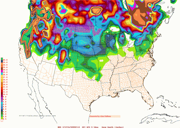
On December 25, it looks like snowfall is possible across Norway and Swedon as an area of low pressure brings increasing moisture across parts of northern Europe. Meanwhile, warm temperatures will likely occur across central and eastern Europe. For now, the UK could see cooler air pushing into the region with a shot of showers. Snow, however, looks unlikely at this time.
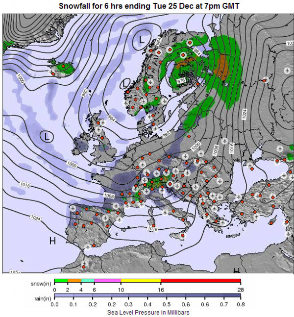
Bottom line: If you live in the southern parts of the United States and across Europe, your chances of seeing a white Christmas are pretty slim. However, if you live in the Pacific Northwest, the Rocky Mountains, northern Great Plains, the Great Lakes area, and the Northeast, your chances of seeing a white Christmas increase greatly. Remember, all you need is at least one inch of snow on the ground to consider it as a white Christmas. EarthSky wishes everyone a safe and happy holiday and a happy New Year!


