


Near the California coast between Monterey and Big Sur, the Soberanes fire is still burning. The wildfire started on July 22, 2016, along Soberanes Creek in Garrapata State Park and has moved into Los Padres National Forest.
As of today (August 2, 2016) InciWeb reports that the Soberanes fire has burned 43,400 acres (an area larger than San Francisco) and just 18 percent of the perimeter is contained by firefighters. At least 57 residences and 11 outbuildings have been destroyed. Roads, schools and state parks have been closed, and hundreds of people have been evacuated. One man has died.
According to a July 30 news report:
The fire is expected continue to grow and experts with the US Forest Service said the worst-case scenario it is planning for is 165,000 acres…Full containment is not expected until the end of August, Cal Fire said.
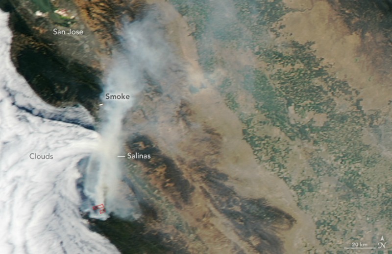
The image at the top was captured by NASA’s Aqua satellite on July 30, as smoke from the fire blew north and east over the California Coast Ranges and into the Central Valley.
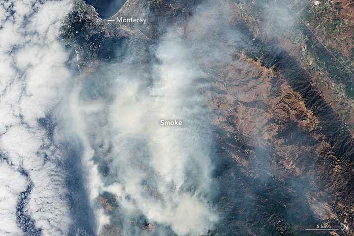
A day earlier, NASA’s Landsat 8 satellite acquired the image below. In the natural-color image, thick smoke mostly obscures the land surface.
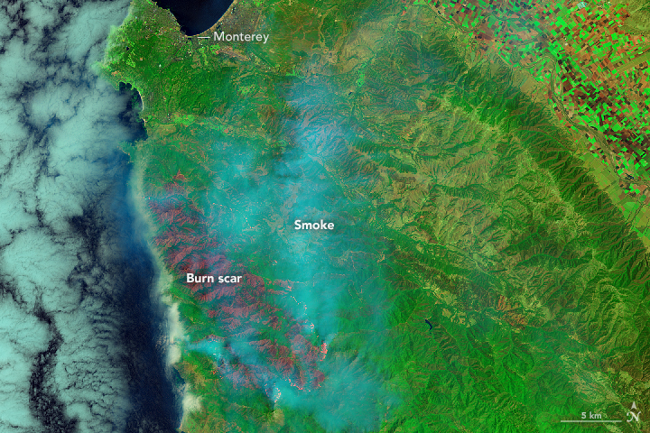
In this second image from Landsat (below) the combination of shortwave infrared, near-infrared, and green light penetrates the smoke and lets you see a clearer view of the burn scar.
Get updates on the fire from Cal Fire and InciWeb
Bottom line:NASA satellite images of the Soberanes fire in California from late July, 2016.
Like what you read?
Subscribe and receive daily news delivered to your inbox.
More from
Eleanor Imster


