


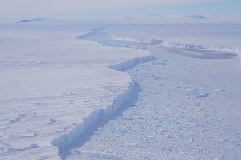
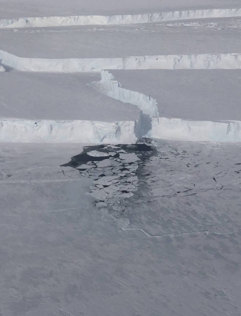
On November 7, 2018, NASA’s Operation IceBridge flew over an iceberg that’s about three times the size of Manhattan. It was the first time anyone had laid eyes on the giant iceberg – dubbed B-46 – that broke off from Pine Island Glacier in late October.
Pine Island Glacier in West Antarctica is known for dispensing icebergs into the Amundsen Sea, but scientists say the frequency of such events appears to be on the rise. At the end of October, the Sentinel-1 satellite observed the glacier letting go of about 115 square miles (300 square km) of ice. The largest piece, iceberg B-46, accounted for 87 square miles (226 square km).
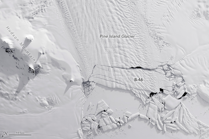
A NASA satellite acquired this image (below) of the new iceberg on November 7, 2018.
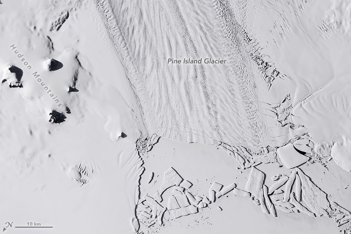
For comparison, the satellite image below shows the same area on September 17, 2018, before a rift quickly propagated across the glacier and spawned the bergs.
Ice shelves, floating glacial ice areas that surround much of Antarctica, calve – break off – icebergs as part of the natural process of ice flowing out to sea. But scientists are watching closely to see if the frequency of calving events is changing over time. The calving of iceberg B-46 is the latest in a string of near-annual events; Pine Island Glacier has shed icebergs in 2013, 2015, 2017, and 2018. Prior to 2013, such events happened about every six years. The crack that would become B-46 was first noticed in late September 2018 and the iceberg broke away about a month later.
According to Joe MacGregor, glaciologist and project scientist for NASA’s Operation IceBridge, the change in calving frequency is likely related to thinning of the ice shelf. Thinning can destabilize the shelf because it loses contact with “pinning points” (locations where the ice shelf touches high points in the sea floor) that strongly influence how the shelf calves.
According to NASA research, Pine Island and nearby Thwaites Glacier alone are contributing about 1 millimeter per decade to global sea level rise, as their flow of ice to the sea has accelerated in recent years.
EarthSky’s 2019 lunar calendars are here! Order yours before they’re gone. Makes a great gift.
Bottom line: Giant iceberg B-46 broke off from Pine Island Glacier in late October 2018. Scientists say the frequency of such events appears to be on the rise.
Like what you read?
Subscribe and receive daily news delivered to your inbox.
More from
Eleanor Imster


