


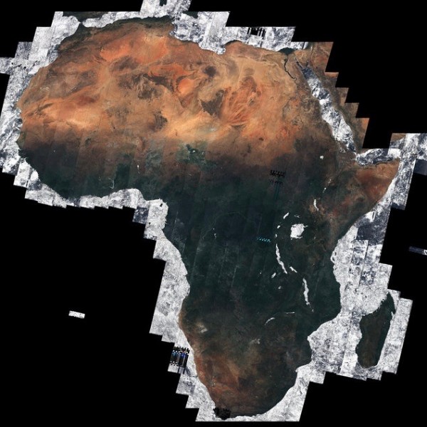
ESA’s Sentinel-2A satellite captured almost 7,000 images to make this mosaic showing a cloud-free view of the African continent – about 20% of the total land area in the world.
The majority of these separate images were taken between December 2015 and April 2016
Sentinel-2A has an orbit that causes it to revisit Earth’s equator every 10 days. Nevertheless, ESA said:
… being able to capture the Tropics cloud-free over the five months is remarkable.
Presented at the recent Living Planet Symposium in Prague, Czech Republic, this is the first mosaic of Africa generated through ESA’s Climate Change Initiative Land Cover project.
Read more about this image from ESA.
Like what you read?
Subscribe and receive daily news delivered to your inbox.
Thank you! Your submission has been received!
Oops! Something went wrong while submitting the form.
More from
Deborah Byrd
View All


The northernmost sunset is on the June solstice, today!
June 21, 2026
The Crow, Cup and Water Snake in June skies
June 16, 2026


