


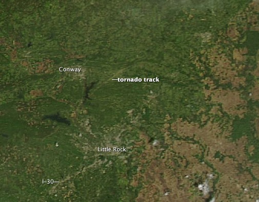
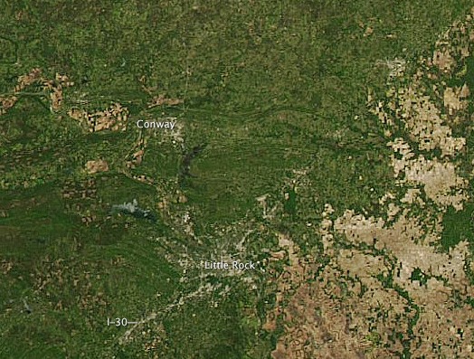
The image above, acquired on April 28 by the Moderate Resolution Imaging Spectroradiometer (MODIS) on NASA’s Aqua satellite, shows what appears to be a tornado track north of Little Rock, Arkansas. The image below, from April 25, two days before the tornado, shows the same area before the storm. The tracks are pale brown trails where trees and plants have been uprooted, leaving disturbed ground.
Like what you read?
Subscribe and receive daily news delivered to your inbox.
Thank you! Your submission has been received!
Oops! Something went wrong while submitting the form.
More from
Editors of EarthSky
View All


Scorpius the Scorpion and its legendary stinger
July 10, 2026
Guy Ottewell honored with an asteroid in his name
July 7, 2026
July birthstone: The rare and precious ruby
July 1, 2026


