NASA’s Terra satellite captured this image of the Colby fire just before noon on January 16. Image via NASA Earth Observatory
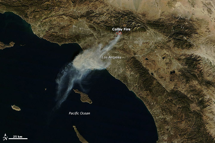
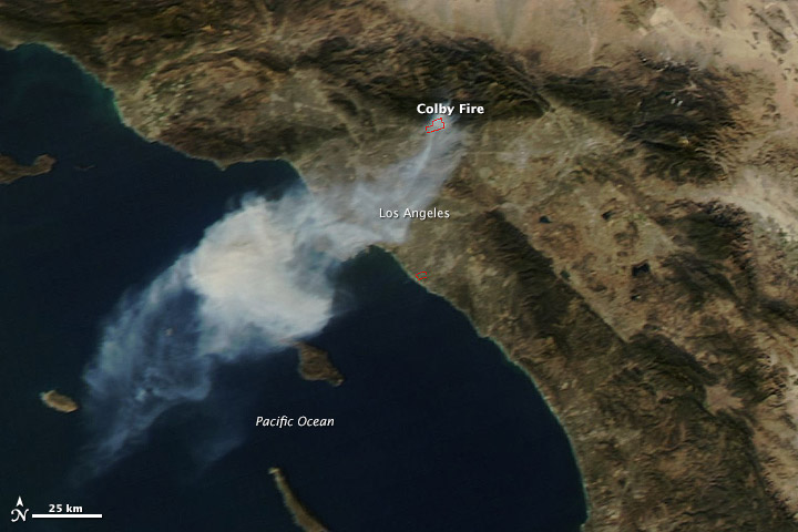
Here are two images of the Colby Fire, via NASA’s Terra satellite. The fire started yesterday (January 16, 2014) in the foothills northeast of Los Angeles and rapidly spread. The image at top is from just before noon yesterday, and the image below is from just after noon. We heard from many yesterday about the smokey skies in Los Angeles, which issued air quality warnings.
NASA says the morning image is clearer because the scene was centered under the satellite, while the afternoon image is fuzzy because the satellite was observing from an angle.
InciWeb this morning (January 17) says that the fire is now 30% contained and that 1,709 acres have burned. A Red Flag Warning has been extended to today due to a Santa Ana wind event. As of 3 p.m. local time on Thursday, nearly 500 firefighters were working the fire, which had destroyed at least two homes.
Deborah Byrd (asteroid 3505 Byrd) helps edit EarthSky.org and is a frequent host of EarthSky videos. Deborah created the EarthSky radio series in 1991 and founded EarthSky.org in 1994. Prior to that, she had worked for the University of Texas McDonald Observatory since 1976, and created and produced their Star Date radio series. She has won a galaxy of awards from the broadcasting and science communities, including having an asteroid named in her honor in 1990, a Public Service Award from the National Science Board in 2003, and the Education Prize from the American Astronomical Society in 2020. A science communicator and educator since 1976, Byrd believes in science as a force for good in the world and a vital tool for the 21st century. "Being an EarthSky editor is like hosting a big global party for cool nature-lovers," she says.
Like what you read? Subscribe and receive daily news delivered to your inbox.
Thank you! Your submission has been received!
Oops! Something went wrong while submitting the form.