


This video shows the progression of a major winter storm in the U.S. south from February 10 at 1815 UTC/1:15 p.m. EST to yesterday (February 12) at 1845 UTC/1:45 p.m. EST. It’s a compilation of satellite images made into a video by NASA/NOAA’s GOES Project at NASA’s Goddard Space Flight Center in Greenbelt, Maryland.
Today, this same storm that brought heavy snows and significant ice accumulations to portions of the Southeast yesterday begins its track up the U.S. Eastern Seaboard.
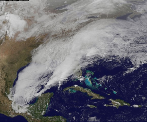
Here’s a NASA satellite image of the storm yesterday (February 12) at about 2 p.m. EST
Bottom line: A video compilation of NASA/NOAA satellite images shows the progression of a major winter storm in the U.S. south from February 10 to February 12.
Like what you read?
Subscribe and receive daily news delivered to your inbox.
Thank you! Your submission has been received!
Oops! Something went wrong while submitting the form.
More from
Eleanor Imster
View All


Copernicus’ revolution and Galileo’s vision, in pictures
February 19, 2025
1st photo of Earth from space, 78 years ago
October 24, 2024
Comets and asteroids: What’s the difference?
January 31, 2023
Sputnik launched 65 years ago
October 4, 2022


