


This image was captured by the Moderate Resolution Imaging Spectroradiometer (MODIS) on NASA’s Terra satellite on January 26, 2014. The remarkably cloud-free view shows the range of ecological diversity present on Hawaii’s Big Island.
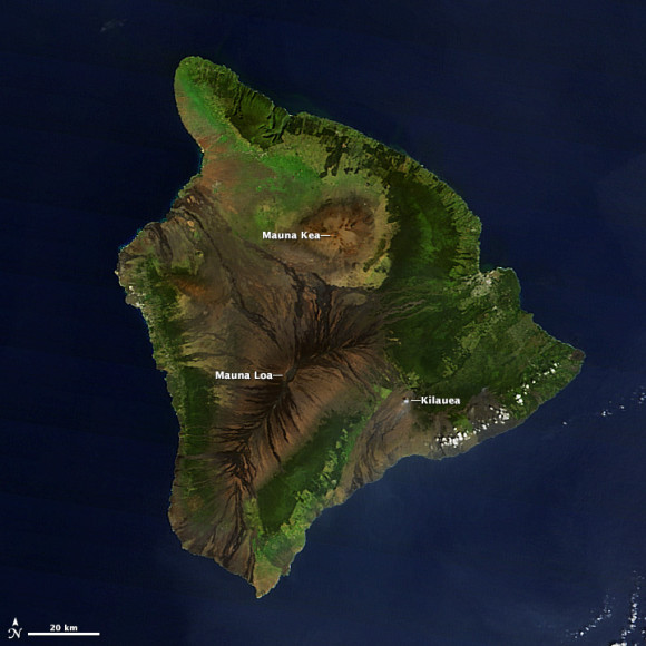
The Big Island is home to Mauna Kea, the tallest sea mountain in the world at 4,205 meters (13,796 feet) and the tallest mountain on the planet—if you measure from seafloor to summit, a distance of more than 9,800 meters (32,000 feet). Both Mauna Loa and Mauna Kea are volcanic, though only Mauna Loa has been active recently. But Kilauea is one of the world’s most active volcanoes. A small puff of steam rises from an erupting vent in this image. Black and dark brown lava flows extend from both Kilauea and Mauna Loa.
The east side of the island is lush and green with tropical rainforest. Much less moisture makes it to the lee side of the mountains. The northwestern shores of Hawaii are desert. Kona, on the western shore, receives plenty of rain because the trade winds curve back around the mountains and bring rain. Pale green areas on all sides of the island are agricultural land and grassland.
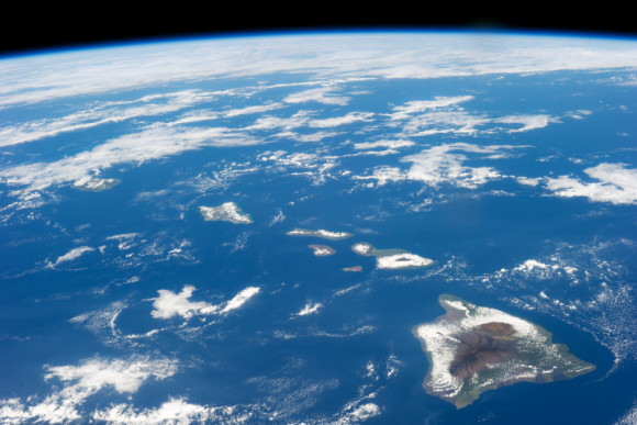
The image below was taken by an astronaut aboard the International Space Station (ISS) on January 18, 2014. This image shows the shows the island in context. At 10,432 square kilometers (4,028 square miles), Hawaii’s Big Island is nearly twice as big as all of the other islands combined.
Like what you read?
Subscribe and receive daily news delivered to your inbox.
More from
Eleanor Imster


