As of Friday night (June 10), the Wallow fire in Arizona had burned nearly 409,000 acres in the Apache-Sitgreaves National Forest, according to Inciweb (updated 03 UTC June 11, or 10 p.m. CDT on June 10). Here is a series of three images of the Arizona fires, which started on May 29, 2011.
Approximately 3,012 people are working to contain the fire, which on June 9 was just five percent contained, according to NASA. Calmer winds on June 10 were predicted to help firefighters make more progress on containing the fire, said InciWeb. NASA image courtesy Jeff Schmaltz, MODIS Rapid Response Team at NASA GSFC.
NASA’s Terra satellite aboard MODIS flew over the Wallow fire on June 9, 2011 to acquire the image above. Notice how the central part of the burned area is more quiescent than the edges. You can see how the fire has expanded outward.
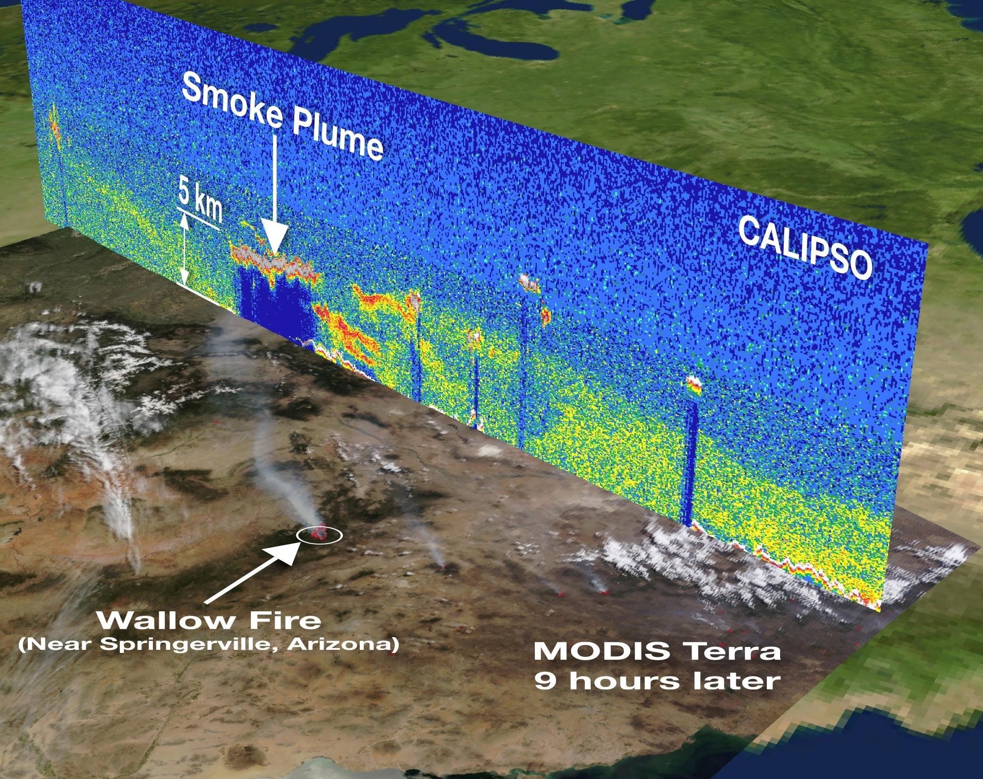
This next image shows the Wallow fire plume – nearly five kilometers (three miles) above Earth’s surface.
Click to expand image. Image Credit: NASA /Kurt Severance, Jason Tackett and CALIPSO Team.
NASA’s CALIPSO satellite captured the data used to create the image above on June 3, 2011. The image is overlaid on an image captured by the Moderate Resolution Imaging Spectroradiometer (MODIS) instrument on the Terra satellite nine hours later.
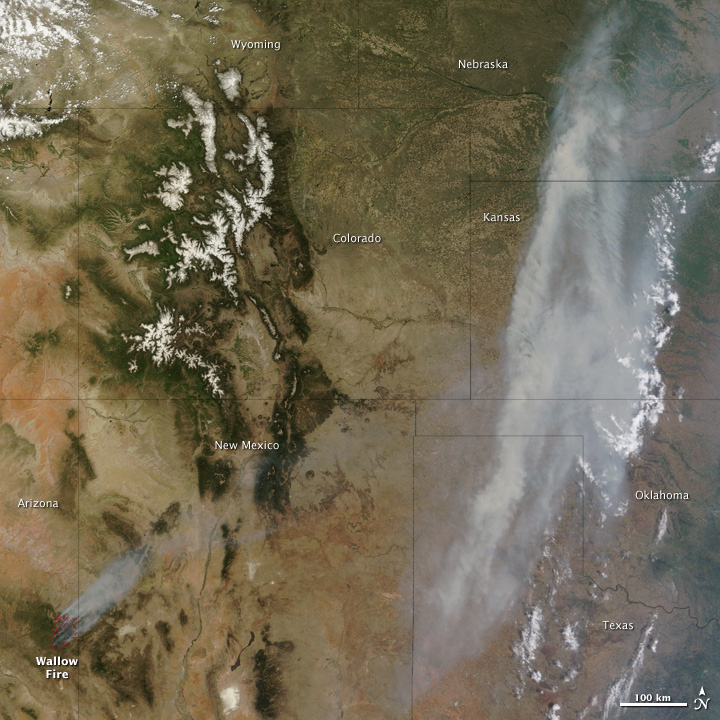
The last image on this page shows how, as the Arizona fires raged, smoke poured across the United States, clouding skies over the Midwest.
Click to expand image. NASA image courtesy Jeff Schmaltz, MODIS Rapid Response Team at NASA GSFC.
At 11:05 a.m. Arizona time on June 7, when the MODIS instrument on the Terra satellite acquired this image, a dense band of smoke was visible from Texas to Nebraska. Winds had blown the smoke eastward from New Mexico, Colorado and Wyoming, where it had hovered on June 5.
Bottom line: By Friday evening, June 10, the Wallow fire in Arizona had burned nearly 409,000 acres. Approximately 3,012 people are working to contain the fire, which is now just five percent contained, according to NASA. Calmer winds on June 10 should help firefighters make more progress on containing the fire, said InciWeb.
Video reports on Arizona wildfires from evening June 8


