


El Nino, a phase of warm sea surface temperatures in the central and eastern equatorial Pacific, is not quite here, scientists have concluded in their latest status update that was issued on December 4, 2014. Currently, there is a 65% chance that El Nino will develop this winter and last until spring. If El Nino does develop, it is expected to be weak.
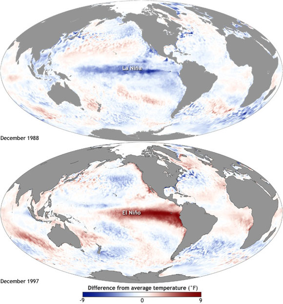
El Nino events, which reoccur about every 3 to 4 years, impact weather conditions across the globe. Typically, several areas in Indonesia and Australia are drier than normal during El Nino events, whereas parts of the southern United States are wetter than normal. El Nino events are also associated with milder winter temperatures in parts of western Canada and northern regions of the United States.
Scientists in the U.S. have developed three criteria that must be met before an El Nino event can be declared. The first involves sea surface temperatures—sea surface temperatures must remain 0.5 degrees Celsius above normal for at least one month in a particular region (5°N–5°S, 170°W–120°W) of the equatorial Pacific Ocean. This criterion has been met. Sea surface temperature anomalies were above 0.5 degrees Celsius in this region during the later part of October and the entire month of November.
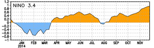
The second criterion involves the likelihood that warm sea surface temperatures will continue to exceed the 0.5 degrees Celsius threshold during the months ahead. Scientists are indeed expecting that sea surface temperatures will remain warm; hence, the second criterion has been met as well.
The third criterion involves the presence of atmospheric conditions that resemble patterns typically seen during an El Nino event. So far, the atmosphere has not exhibited El Nino-like patterns. Specifically, there was less rainfall over parts of the central Pacific Ocean in November than would be expected for an El Nino event. Therefore, the third criterion has not been met and no El Nino event has been declared.
Next month could be a different story.
The El Nino status reports (pdf) are issued the first Thursday of every month by the National Oceanic and Atmospheric Administration’s (NOAA’s) Climate Prediction Center, which is part of the National Weather Service.
Bottom line: The latest status update from NOAA that was issued on December 4, 2014 indicates that a full blown El Nino event still has not developed in the equatorial Pacific Ocean. Currently, there is a 65% chance that El Nino will develop this winter and last until spring. If El Nino does develop, it is expected to be weak.
Like what you read?
Subscribe and receive daily news delivered to your inbox.
More from
Deanna Conners


