


January 20, 2019
Jan Curtis
Cheyenne, Wyoming, USA
Cheyenne, Wyoming, USA
12/17/2021
10:00 am
10:00 am
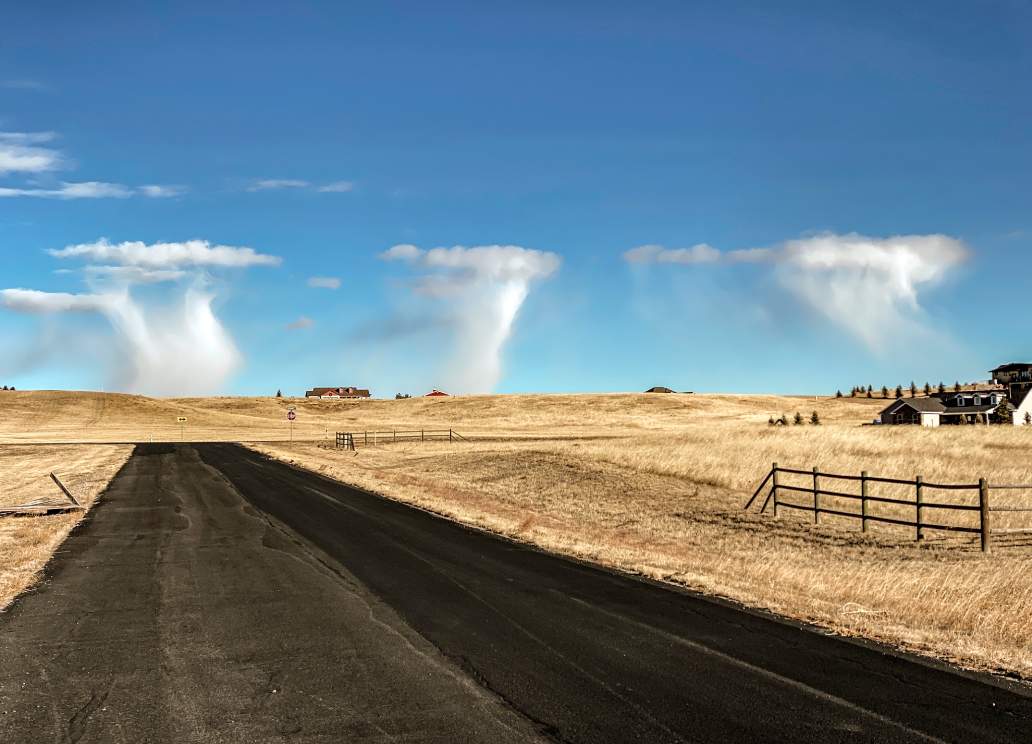
This event is rather unusual if not rare. The lower levels of the atmosphere are very cold and moist. Lots of virga (ice crystals) are falling out of these thin cloud masses. Had this occurred in summer, severe weather is most likely later in the day. On this day, scattered convective snow shower occurred shortly after this mid-morning capture.
An alternative cloud classification could be: Altocumulus Floccus Clouds With Virga but I believe these clouds were well below 6000 above ground level.
I upload a time lapse of this event: www.flickr.com/photos/79387036@N07/51753641288
Posted
January 20, 2019
in
Like what you read?
Subscribe and receive daily news delivered to your inbox.
Thank you! Your submission has been received!
Oops! Something went wrong while submitting the form.
More from
David Callejas
View All


Sometimes Island on Lake Travis
August 13, 2024
Sunset on Lake Travis
July 20, 2024
Ready, set, explore Earth from home
January 14, 2021
Two planets destined to die as their star expands
June 2, 2014


