


Mars craters pop in new images
The terrain of Mars has pockmarks and ripples from a variety of forces: asteroid collisions, volcanoes, wind erosion, and the movement of water and ice. New images from Mars highlight the diversity of the red planet’s craters. ESA released the new images on May 15 and 16, 2024, from the ExoMars mission. Its Trace Gas Orbiter’s Color and Stereo Surface Imaging System (CaSSIS) caught the views seen here from some 250 miles (400 km) above the surface.
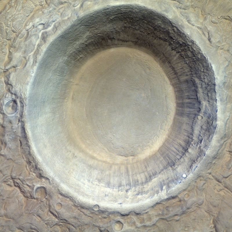
In the image at top, we see some of the carnage left behind in the largest known impact basin in the solar system. Mars’s Utopia Planitia is a region in the northern hemisphere containing a large amount of underground ice. The 5-mile-wide (8-km-wide) crater above formed when an asteroid smashed into Mars and ejected dust and melted water ice. Inside the smooth crater, you can even see evidence of landslides. The press release said:
Understanding the history of water on Mars and if this once allowed life to flourish is at the heart of ESA’s ExoMars missions.
Southern highlands crater
The image below is from the southern hemisphere’s highlands region. You can see from its rougher appearance that it’s older than the crater above. This crater has more weathering and many more smaller impacts inside the crater rim. The central uplift is also a sign of greater age. The 9-mile-wide (15-km-wide) crater has dark dunes and lighter-colored ripples on its ancient floor.

Craters in Valles Marineris
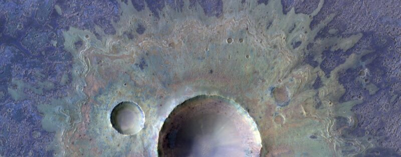
The craters below lie in the Valles Marineris region of Mars, famous for being the largest canyon in the solar system. To accentuate the mineral composition of the craters, the imaging team used false coloring. The team also used infrared data to showcase these craters and ejecta blankets. The colors allow us to see where the crater and debris is wearing down, as the blue begins to show through.
The press release said:
The shape and texture of the ejecta blanket show that the surface was not completely dry at the time of impact. Water ice in the subsurface mixed with fractured rock and dust formed a ‘fluidized’ mass of material that was ejected outward from the center of the impact site. This indicates that there was water ice present in the surface at the time of impact.
The larger crater is 2.5 miles (4 km) wide. The smaller crater to the left is 0.7 miles (1.1 km) wide.
Bottom line: Mars craters pop in these new images showcasing the diversity of impacts across the red planet. ESA’s ExoMars mission took these images.
Like what you read?
Subscribe and receive daily news delivered to your inbox.
More from
Kelly Kizer Whitt


