


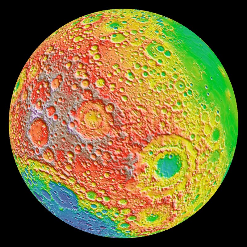
Map of the moon
This new map of the moon is the highest resolution topographic lunar map ever created. The map shows the ups and downs of over 98.2% of the entire lunar surface with a pixel scale close to 100 meters (328 feet). A single measure of elevation (one pixel) is about the size of two football fields placed side-by-side.
The science team that oversees the imaging system on board NASA’s Lunar Reconnaissance Orbiter (LRO) created the map.
Although the moon is our closest neighbor, knowledge of its morphology is still limited. Until the LRO mission, there haven’t been instruments able to create such a high resolution global map of the moon’s topography. With the LRO Wide Angle Camera and the Lunar Orbiter Laser Altimeter (LOLA) instrument, scientists can now accurately portray the shape of the entire moon at high resolution.
Mark Robinson, of Arizona State University, is Principal Investigator of the Lunar Reconnaissance Orbiter Camera (LROC). He said:
Our new topographic view of the moon provides the dataset that lunar scientists have waited for since the Apollo era. We can now determine slopes of all major geologic terrains on the moon at 100 meter scale. Determine how the crust has deformed, better understand impact crater mechanics, investigate the nature of volcanic features, and better plan future robotic and human missions to the moon.
Bottom line: Highest resolution topographic map of the moon! It shows the ups and downs of over 98.2% of the entire lunar surface.
Like what you read?
Subscribe and receive daily news delivered to your inbox.
More from
Editors of EarthSky


