
Sign Up for Our Amazing Newsletter!
A daily update by email. Science news, great photos, sky alerts.

EarthSky Community Photos
Submit your photo here. Comment or upvote on photo pages. Search via photographers' names. More improvements coming! To help, please donate.
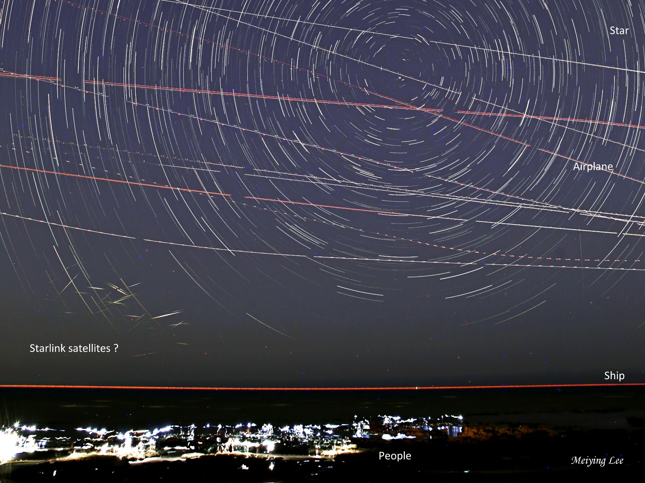
Taoyuan, Taiwan
10:13 pm
Canon 6D + 24mm Lens
The shooting took place from 10:13 PM to 11:00 PM, with each exposure lasting 20 seconds. A total of 136 photos were combined using Startrails software.
This photo has been cropped and enlarged.
On May 27th, I captured and stacked this photo of star trails near Taiwan's largest international airport. The shooting took place from 10:13 PM to 11:00 PM, with each exposure lasting 20 seconds. A total of 136 photos were combined using Startrails software. In the photo, besides the trails created by the stars rotating around the North Star, I also captured various other trails. Being near the airport, there were many airplane trails from takeoffs and landings. The landscape below the photo is the coastline, and the red dashed line represents the trail of a distant ship, which happened to mark the position of the sea level. The various bright lights at the bottom are people enjoying their time at the beach on a weekend evening. What surprised me the most were the numerous short and momentary trails in the lower-left part of the photo. Within less than an hour of exposure, there were nearly 30 intersecting short trails. Upon closer examination, I noticed that these trails were concentrated near the western part of the northern horizon, suggesting they were Starlink satellites. These low-orbit satellites reflected sunlight that had already set, creating brief and momentary trails. I also observed that the appearance of these satellite trails followed a regular pattern, moving diagonally down to the right (north), consistent with the movement of the sun. Perhaps from this photo, we can get a glimpse of the impact of Starlink satellites on the night sky.


