


Science matters. Wonder matters. You matter.
Join our 2025 donation campaign today.
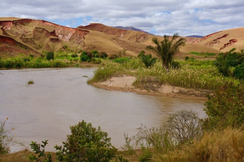
- Madagascar has distinct topography on its eastern and western sides. Over time, its rivers first drained eastward and then reversed course, draining westward. Why did the rivers switch direction?
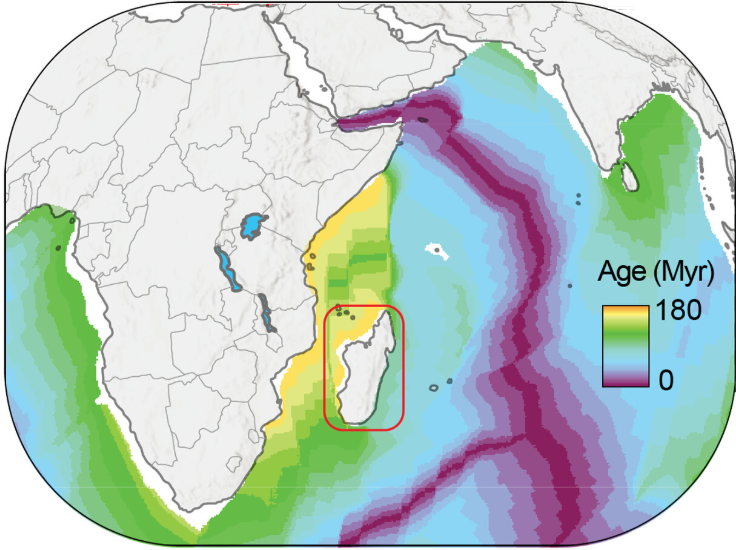
- The island ripped apart first from Africa and then, 80 million years later, tore from India. That’s according to a new study that looked at the ancient rifting and tilting of this region.
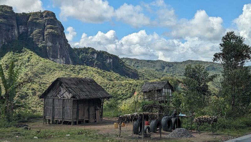
- Today, Madagascar is one of the most biologically diverse places on Earth. More than 90% of its mammals and reptiles and more than 80% of its plants exist nowhere else.
ETH Zurich published this original story on October 23, 2025. Edits by EarthSky.
Madagascar: The island split in two by time
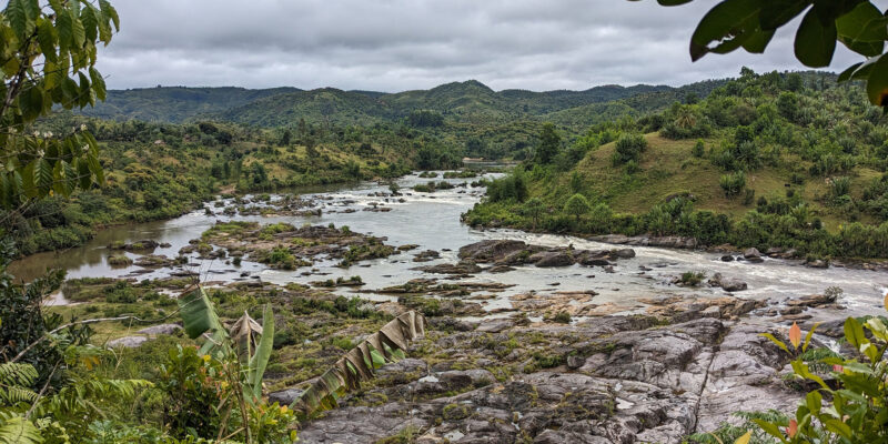
Madagascar’s landscape tells a story of deep time. Ancient rifting and geological tilting sculpted the island’s dramatic topography. And this geologic activity steered its rivers, setting the stage for the evolution of its extraordinary biodiversity.
A new study published in Science Advances on October 15, 2025, reveals that Madagascar’s striking landscape was shaped by not one, but two great rifting events, separated by nearly 80 million years. These tectonic shifts first tore the island from Africa, then from India, tilting and reshaping its terrain and setting the stage for life to flourish in isolation.
Madagascar first separated from Africa about 170 million years ago, forming a rugged western escarpment and an eastward-tilted plateau. For tens of millions of years, its rivers drained mainly eastward across this landscape.
When Africa and Madagascar split apart
But around 90 million years ago, a second rift opened on the island’s eastern side, separating Madagascar from India and the Seychelles. The crust thinned again: But this time the island tilted in the opposite direction, toward the west. The consequences were dramatic. Rivers reversed course, the island’s main water divide shifted eastward and a new, steep escarpment formed along the Indian Ocean margin.
When landscapes tilt and new life emerges
Romano Clementucci from ETH Zurich is the lead author of the new Science Advances study. Clementucci said:
The key to understanding Madagascar’s landscape lies in its water divide. When the island tilted after each rifting event, the main water divide – the line separating rivers flowing east or west – jumped across the island, transforming its hydrology and erosion patterns.
The island’s drainage system was almost completely reorganized. Old rivers reversed direction or abandoned their channels to follow the new westward slope, and erosion patterns flipped as well.
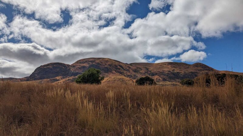
Over time, the western escarpment evolved into a worn-down landscape of remnant highlands and low-relief plateaus. Meanwhile, the east developed a young, linear and steep escarpment … today’s most recognizable feature of Madagascar.
A driver of evolution
Madagascar is now one of the world’s most celebrated biodiversity hotspots. More than 90% of its mammals and reptiles and more than 80% of its plants exist nowhere else on Earth. Researchers have long attributed this extraordinary biological richness to climate and isolation from the continents. But recent studies, including those by Liu et al. (2024) and Clementucci et al. (2025), add a deeper geological dimension to the story.
The landscape itself may act as a speciation pump. A speciation pump is a concept in evolutionary biology describing a process that repeatedly drives the formation of new species by isolating and reconnecting populations. The migration of the divide didn’t just change where rivers flow, but where life could evolve.
This perspective echoes the vision of Alexander von Humboldt, who two centuries ago proposed a unified theory for understanding biodiversity patterns. The new study contributes to this theory by extending biodiversity drivers from classic climatic hypotheses to erosion process.
Clementucci said:
Our work adds a new piece to the puzzle. We show how ancient tectonic forces reshaped Madagascar’s surface, tilting the island and shifting the main rivers and mountain divides. Over millions of years, this created fragmented environments where species evolved independently, especially along the island’s dramatic eastern escarpment.
Madagascar is stable but dynamic
The broader implication is a shift in how we view so-called “stable” regions such as Madagascar, South Africa, India, Brazil or Australia and other passive margins. Scientists often see these areas as geologically quiet. Yet they host some of the planet’s richest biodiversity. This study shows they are still highly dynamic, with landscapes that continue to evolve … changes which leave a lasting mark on biodiversity.
Bottom line: A new study found that the island of Madagascar formed after two great rifting events. The first tore it away from Africa 170 million years ago. The second tore it from India 90 million years ago.
Source: Madagascar’s landscape evolution: A tale of two rifts
Like what you read?
Subscribe and receive daily news delivered to your inbox.
More from
EarthSky Voices


