


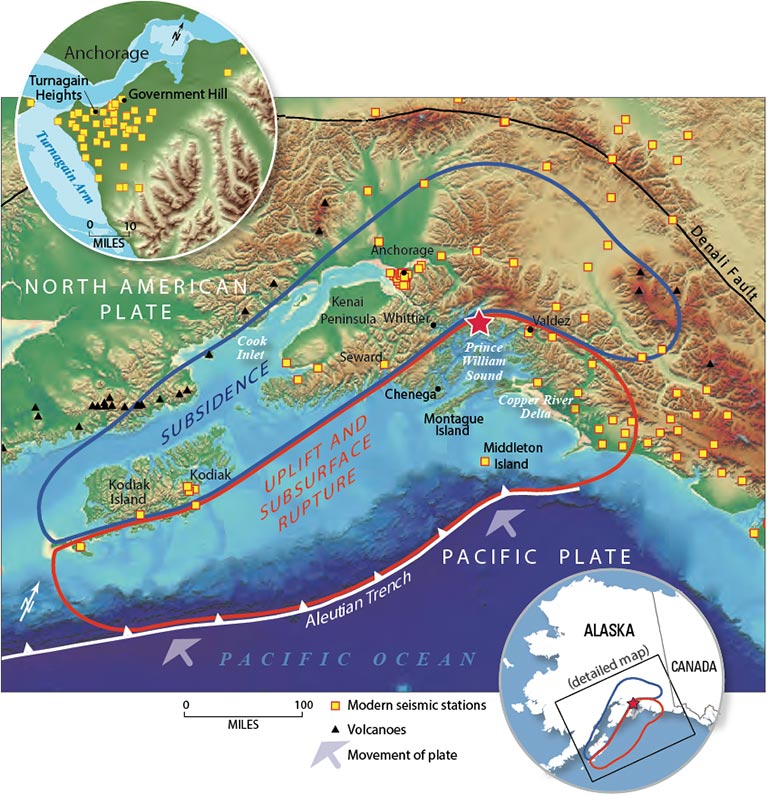
Today in science: March 27, 1964. On this date, the most powerful earthquake ever recorded in North America struck in the Prince William Sound southeast of Anchorage, Alaska, at 5:36 p.m. local time. The 9.2-magnitude temblor rocked the state for more than four minutes, spawning a tsunami that reached all the way to Hawaii and Northern California. The massive quake is known as the Great Alaska Earthquake or the Good Friday Earthquake. According to the U.S. Geological Survey (USGS), it holds the record for the second-largest earthquake ever recorded on Earth, behind the 1960 Chile quake (which had a magnitude of about 9.5).
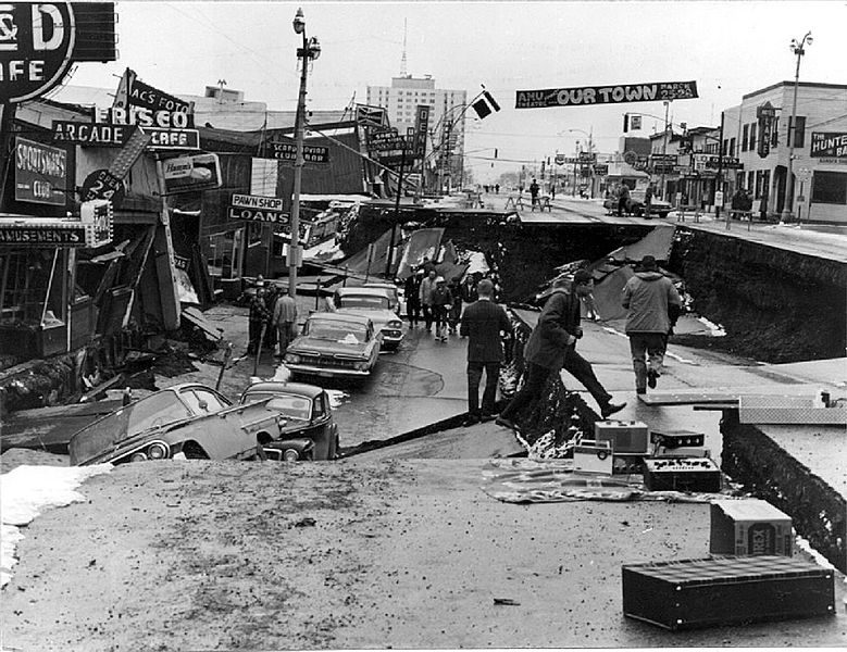
It had been a relatively warm day that day in Anchorage, Alaska’s largest city, about 75 miles (120 km) from the quake’s epicenter. Schools were closed for Good Friday, along with many offices. As the quake began, dozens of blocks of buildings were leveled or heavily damaged in Anchorage.
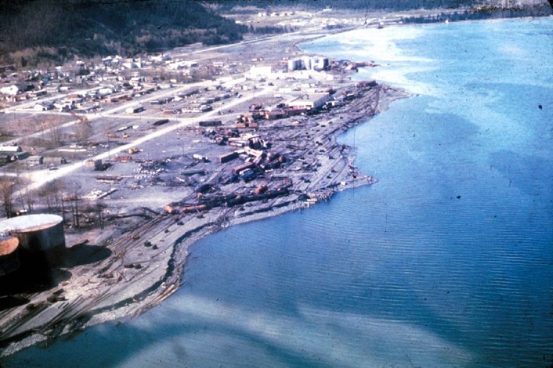
The city of Valdez, closest to the epicenter, was completely destroyed.
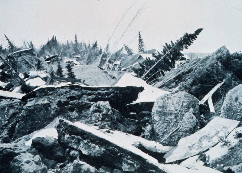
The prolonged shaking resulted in many natural changes as well. The Latouche Island area, for example, moved to the southeast by nearly 60 feet (20 meters), according to the Alaska Earthquake Center.
USGS now estimates the earthquake and its accompanying tsunami caused $311 million in damages across the state of Alaska.

And yet loss of human life was relatively small. Only 130 people were killed. The UAF Alaska Earthquake Center said the low death rate was:
… due to low population density, the time of day and the fact that it was a holiday, and the type of material used to construct many buildings (wood).
The 1964 Great Alaska Earthquake didn’t come close to the loss of life from two slightly smaller and more recent quakes: the December 26, 2004, Indian Ocean 9.1-magnitude earthquake and tsunami (third-largest earthquake recorded on a seismograph, with over 230,000 people killed in 14 countries) and the March 11, 2011, 9.0-magnitude earthquake in Japan (fifth-largest earthquake recorded on a seismograph, with nearly 16,000 deaths).
In 1964, Alaska was sparsely populated. Today’s Alaska has a larger human population. If and when a similar quake strikes again, the death toll might be higher.
Click here for more photos of the 1964 Alaska earthquake.
Bottom line: The most powerful earthquake to ever strike North America rocked south-central Alaska on Good Friday, March 27, 1964, and registered a magnitude 9.2 on the Richter scale.
Like what you read?
Subscribe and receive daily news delivered to your inbox.
More from
Editors of EarthSky


