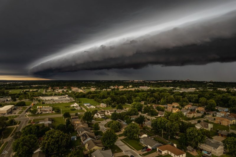
View at EarthSky Community Photos. | Glenn Hughson in Lawrence, Kansas, captured this photo of a shelf cloud on August 31, 2021. He wrote: “I went to let the dog out yesterday morning, when I noticed this shelf cloud quickly approaching. There were several trees and houses blocking my view, so I grabbed my drone and sent it up in the air to get a better look. This thing looked … intimidating … from this view a few hundred feet above my house. It was coming in fast, though, and I didn’t want to lose the drone in the storm. So I snapped a few photos and then quickly landed before the gust front hit. Despite its somewhat scary appearance, this was not a severe storm. It just rained sideways for about 15 minutes before moving on.” Wow. Thank you, Glenn!
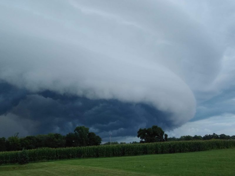
Shelf clouds, also known as arcus clouds, occur at the leading edge of thunderstorms. They announce the arrival of storms and, when combined with cumulonimbus thunderheads, can look like giant alien motherships. Shelf clouds form when the cooler air of a thunderstorm encounters warm, humid air and lifts it. As the shelf cloud passes over you, you’ll notice a drop in temperature, and winds pick up as the gust front moves through. Rain follows soon behind.
Shelf cloud photo gallery
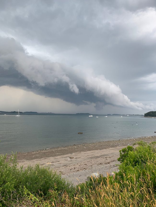
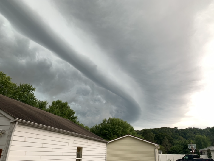
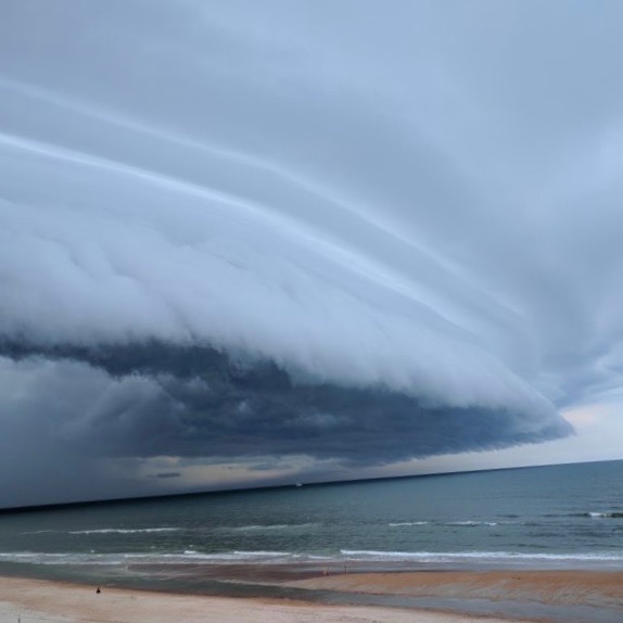
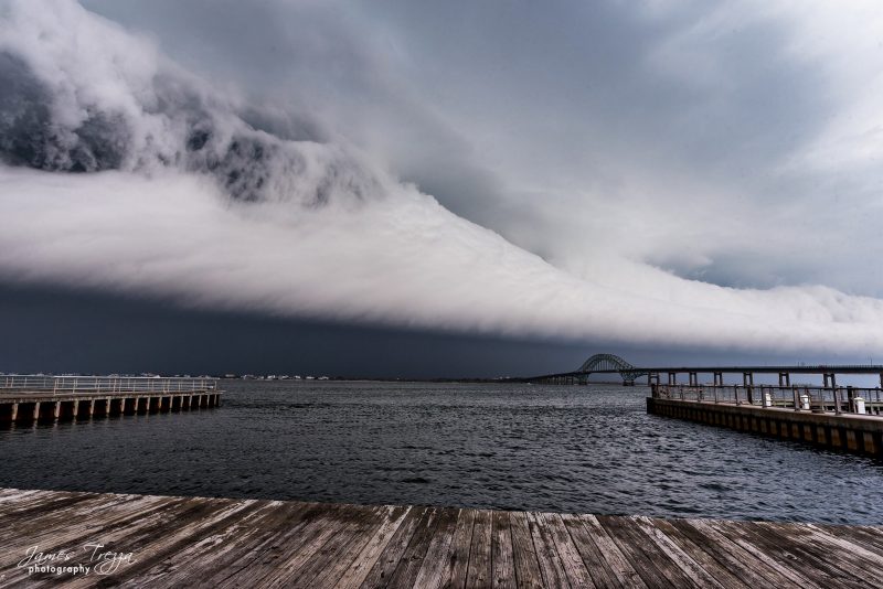
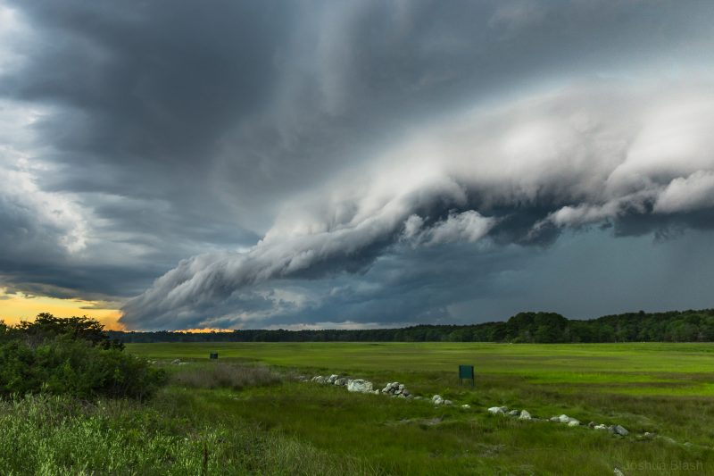
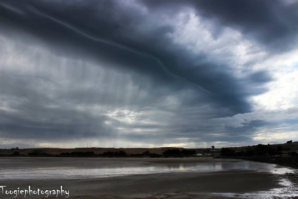
View at EarthSky Community Photos. | Jim Saudade captured this early afternoon shelf cloud over Boston Harbor, Massachusetts, on June 28, 2020. He said: “Shelf cloud quickly followed by pea sized hail and a deluge of rain.”View at EarthSky Community Photos. | Sarah Iler of Birch Run, Michigan, captured this image on August 2, 2020, at 8:39 p.m. She wrote: “Thunderstorms all afternoon and then this shelf cloud formed in the evening. It was amazing.”View at EarthSky Community Photos. | Jay Banfield caught this shelf cloud from Centerton, Indiana, at 11:56 a.m. on August 17, 2019. Jay described it as: “Well-defined shelf cloud ahead of a 15-20 degree temperature drop.”Shelf cloud photographed by Rita Addison at Osmond Beach, Florida, on June 3, 2018.A shelf cloud moving over the Fire Island Inlet Bridge, on Long Island, New York, May 15, 2018, by James Trezza.Josh Blash caught this shelf cloud from Rye, New Hampshire, on July 23, 2016. Josh said: “Everything got very still when I took this, just moments before the fury of the storm began.”Simon Toogood in Tasmania captured this impressive shelf cloud in 2014. He said: “Stormy weather – and shelf clouds like these – are common at this time of year.”
Bottom line: A shelf cloud, also known as an arcus cloud, forms at the leading edge of thunderstorms and signals that gusty winds are coming.
Claudia Crowley proofs and edits EarthSky website material. She says working for EarthSky is the most exciting job she's had except one other - which was editing space shuttle documentation at NASA JSC. After writing and editing manuals for Dell and other major companies, she moved to the technical support side during the wild early days of the Internet, and served as general manager at a small wireless ISP. Claudia is a space enthusiast and fan of science.
Like what you read? Subscribe and receive daily news delivered to your inbox.
Thank you! Your submission has been received!
Oops! Something went wrong while submitting the form.