


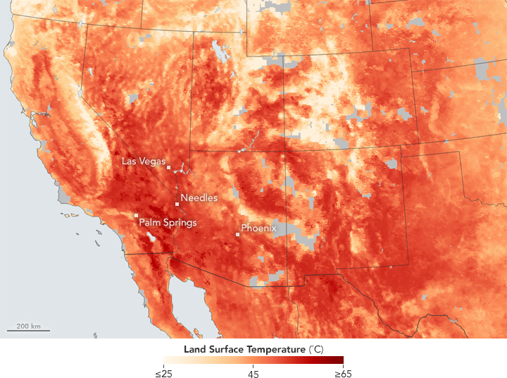
Fires continue to blaze across the U.S. Southwest, which has been hit by a record-breading heat wave since the middle of June. Broad swaths of California, Nevada, Utah, Arizona, and New Mexico all felt the heat. Power companies faced record demand for electricity, dozens of flights were grounded, and some people even died because of the heat.
As of today (June 26, 2017), according to the National Interagency Fire Center, there are currently 17 large fires are burning in the southwestern United States, including five in Arizona, four in California, five in New Mexico, one in Utah, one in Texas, as well as a large one in Oregon.
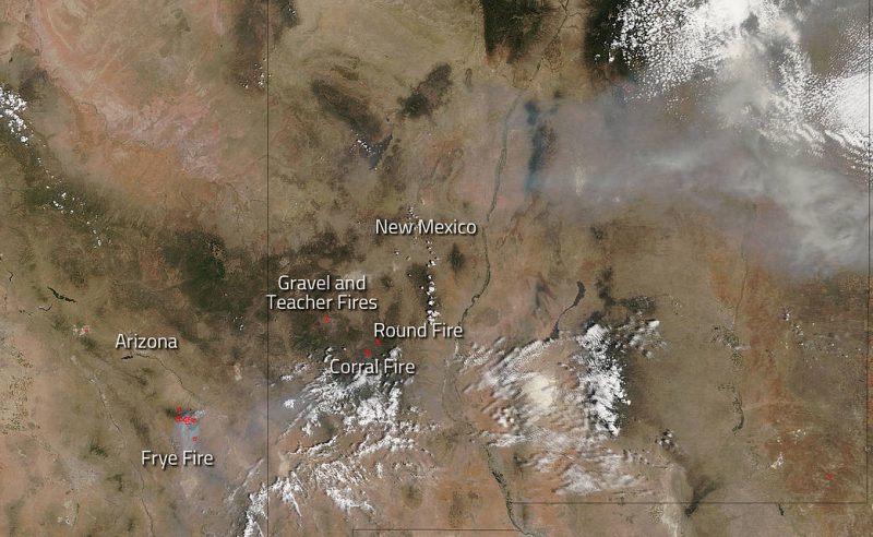
The biggest fire burning now is the Frye Fire in Arizona. It was ignited by a lightning strike on June 7, 2017 in the old burn scar of the 2004 Nuttall Complex Fire. Today, (June 26) the Frye fire was listed on Inciweb as being 35,562 acres in size. That’s significantly larger than just 10 days ago when the fire was 9,100 acres in size. Weather reports favor cooler temperatures and higher humidity which should help firefighters keep the fire in check for the time being.
The satellite image above also shows several fires still burning in New Mexico within the Gila National Forest. The Gravel Fire is currently 2,873 acres. The Teacher Fire remains stable at 3,555 acres. For both of these fires, weather predictions say that low moisture level will generate isolated to scattered showers and thunderstorms. The potential for new lightning starts is high. The Corral Fire is currently 16,924 acres in size. The fire received some precipitation and thunderstorms are expected through Thursday. The Round Fire wildfire is currently 7,269 acres. This particular fire is slowing due to lower temperatures, increased air moisture, and potential for rain.
Bottom line: Wildfires continue to burn across the southwestern United States in late June 2017.
Like what you read?
Subscribe and receive daily news delivered to your inbox.
More from
Eleanor Imster


