


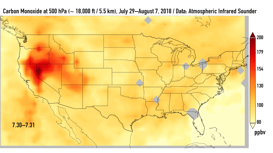
California is being plagued by massive wildfires, and the effects on air quality from those fires can extend far beyond the state’s borders. In addition to ash and smoke, fires release carbon monoxide into the atmosphere. This animation, made from satellite data, shows carbon monoxide from California’s fires drifting eastward starting on July 30, 2018, and reaching the U.S. East Coast by August 7.
Carbon monoxide – a colorless, odorless gas – is a pollutant that can persist in the atmosphere for about one month and can be transported large distances. About half of the carbon monoxide in Earth’s atmosphere is from the burning of fossil fuels and biomass (such as forest and bushfires). Most of the rest of carbon monoxide comes from chemical reactions with organic compounds emitted by human activities and plants. Small amounts are also emitted from the ocean, and from geological activity because carbon monoxide occurs dissolved in molten volcanic rock at high pressures in the Earth’s mantle. It plays a role in both air pollution and climate change.
These satellite images above show the carbon monoxide at an altitude of approximately 18,000 feet (5,500 meters). As the time series progresses, we see that this carbon monoxide is drifting east with one branch moving toward Texas and the other forking to the northeast.
According to a NASA statement:
From space, [the satellite] measures carbon monoxide high up in the atmosphere – where it has little effect on the air we breathe. However, strong winds can carry this pollutant downward to where it can have significant effects on air quality. The time series of images shows just how far the carbon monoxide from California’s wildfires has traveled eastward and what areas may be at greater risk of experiencing its effects.
Bottom line: An animation, made from NASA satellite data, shows carbon monoxide from California’s wildfires drifting eastward across the United States from July 29 to August 7, 2018.
Like what you read?
Subscribe and receive daily news delivered to your inbox.
More from
Eleanor Imster


