


NASA’s Aqua satellite acquired this natural-color image on March 11, 2013 as a striking band of clouds ran roughly northwest to southeast over the open ocean.
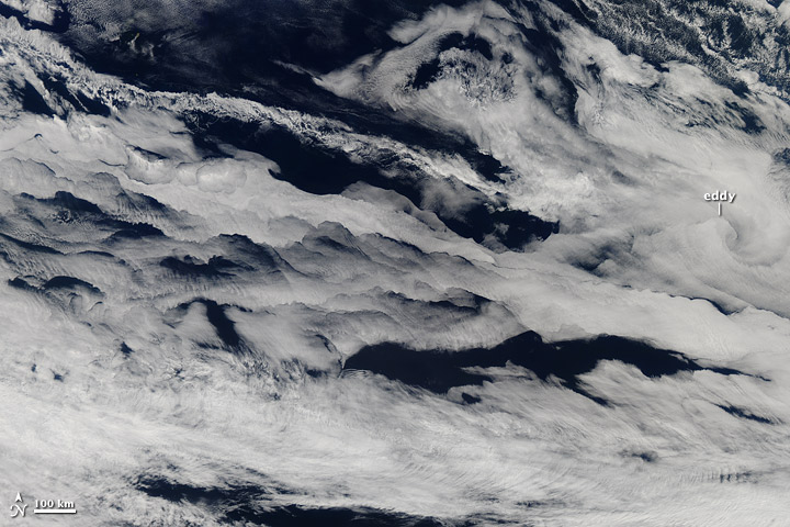
G. Thomas Arnold of NASA’s Ames Earth Science Project Office said that multiple factors interact to develop marine stratocumulus cloud patterns, such as low-level winds, sea-surface temperatures, air temperatures, and rising and sinking air masses.
Read more about it from NASA Earth Observatory
Share your photos with EarthSky on Facebook, or email them to images@earthsky.org.
Don’t miss a single Today’s image. See them all here.
Like what you read?
Subscribe and receive daily news delivered to your inbox.
Thank you! Your submission has been received!
Oops! Something went wrong while submitting the form.
More from
Eleanor Imster
View All


Copernicus’ revolution and Galileo’s vision, in pictures
February 19, 2025
1st photo of Earth from space, 78 years ago
October 24, 2024
Comets and asteroids: What’s the difference?
January 31, 2023
Sputnik launched 65 years ago
October 4, 2022


